George Mandrovny
What Tre Cime di Lavaredo is - and the one thing to get right
Tre Cime di Lavaredo is a roughly 10 km loop hike - three to five hours, moderate - around three sheer rock towers in the heart of the Dolomites. Here is the catch that ambushes almost everyone: the famous north faces are not at the parking lot. Walk the loop counter-clockwise and they swing into view in front of you about 45 minutes in, at Forcella Lavaredo. To drive up you need a license-plate parking reservation for the €40 toll road, and in July it reads Completo - full - by 7:30 in the morning; without a car, you take a shuttle. Come at dawn, or in the afternoon once the lot starts turning over (safest from about 15:30), and you miss the worst of the crush.
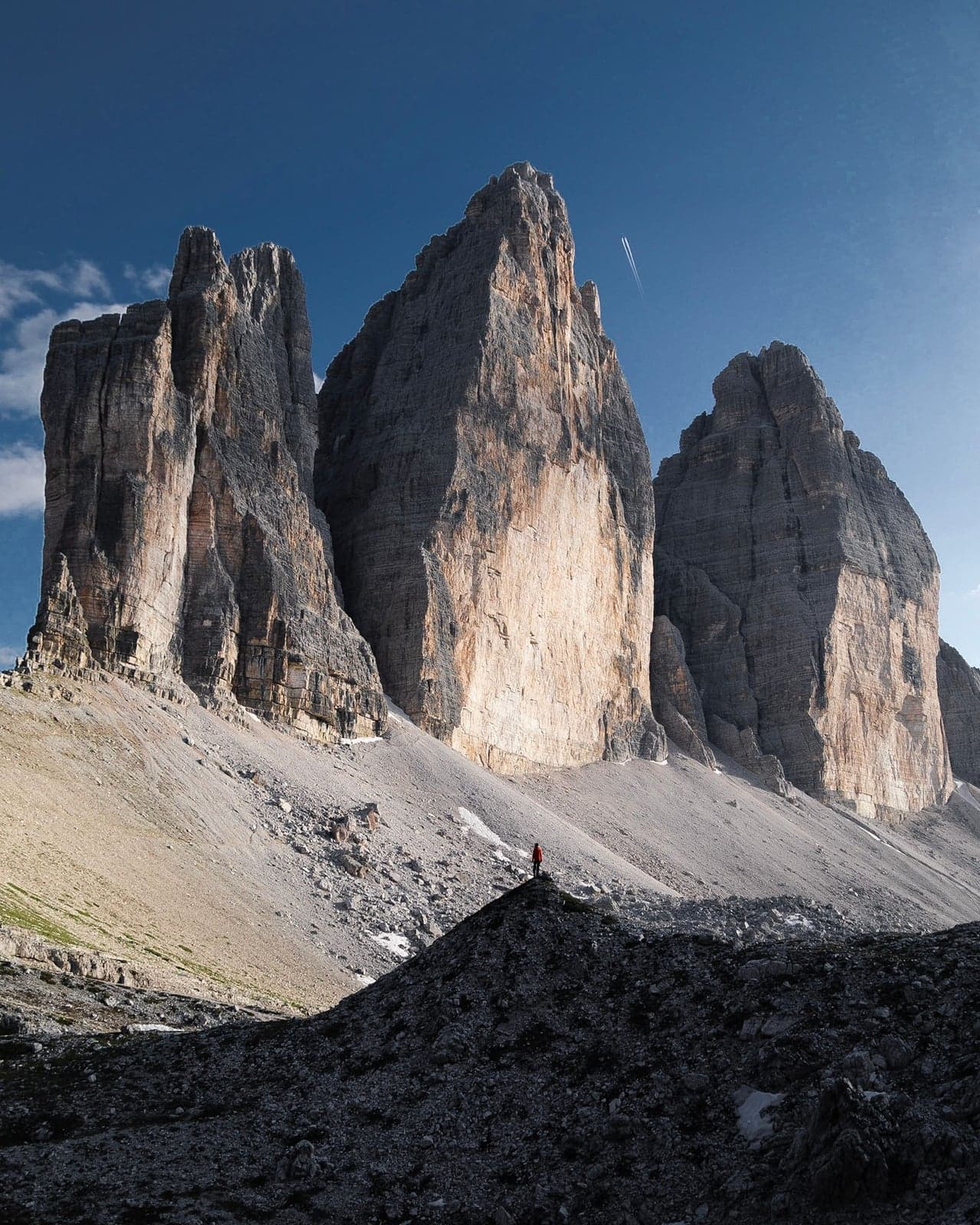
What that walk buys you is one of the great day hikes on the continent. The three towers stand in a line, and because the trail rings all the way around them, you see the same rock head-on, in profile, and from behind over a single morning - no two bends hand you the same mountain. The circuit passes four mountain huts (the rifugi, where you can buy a coffee or a bed), skirts a couple of glacier-fed tarns, and threads past the bunkers and war relics left here from the fighting of the First World War. The whole massif sits inside the Dolomites, a UNESCO World Heritage Site since 2009.
So yes, the logistics are real - a timed toll gate, two separate bus networks, a lot that fills before breakfast - and the next few sections are mostly about beating them. But this is the rare place where the effort and the payoff actually match. Get the gate and the direction right and you walk straight into the view the postcards promise; get them wrong and you spend the day in the crowd, photographing the wrong wall from the parking lot and wondering what the fuss was about. The difference is almost entirely in the planning, which is the good news - planning is the part you can fix.
The gate: the reservation, the €40 timed toll, and the morning fill-up
There is no attendant at the Tre Cime toll gate to reason with, and that is exactly the problem. The road up to Rifugio Auronzo is automated from end to end: the gate checks your license plate against an online reservation, and if that plate was never booked, the barrier stays down. You cannot pay on the spot and you cannot talk your way through. The reservation is tied to your exact plate and made ahead of time on the town's official portal, so missing that one step ends the drive up before it begins.
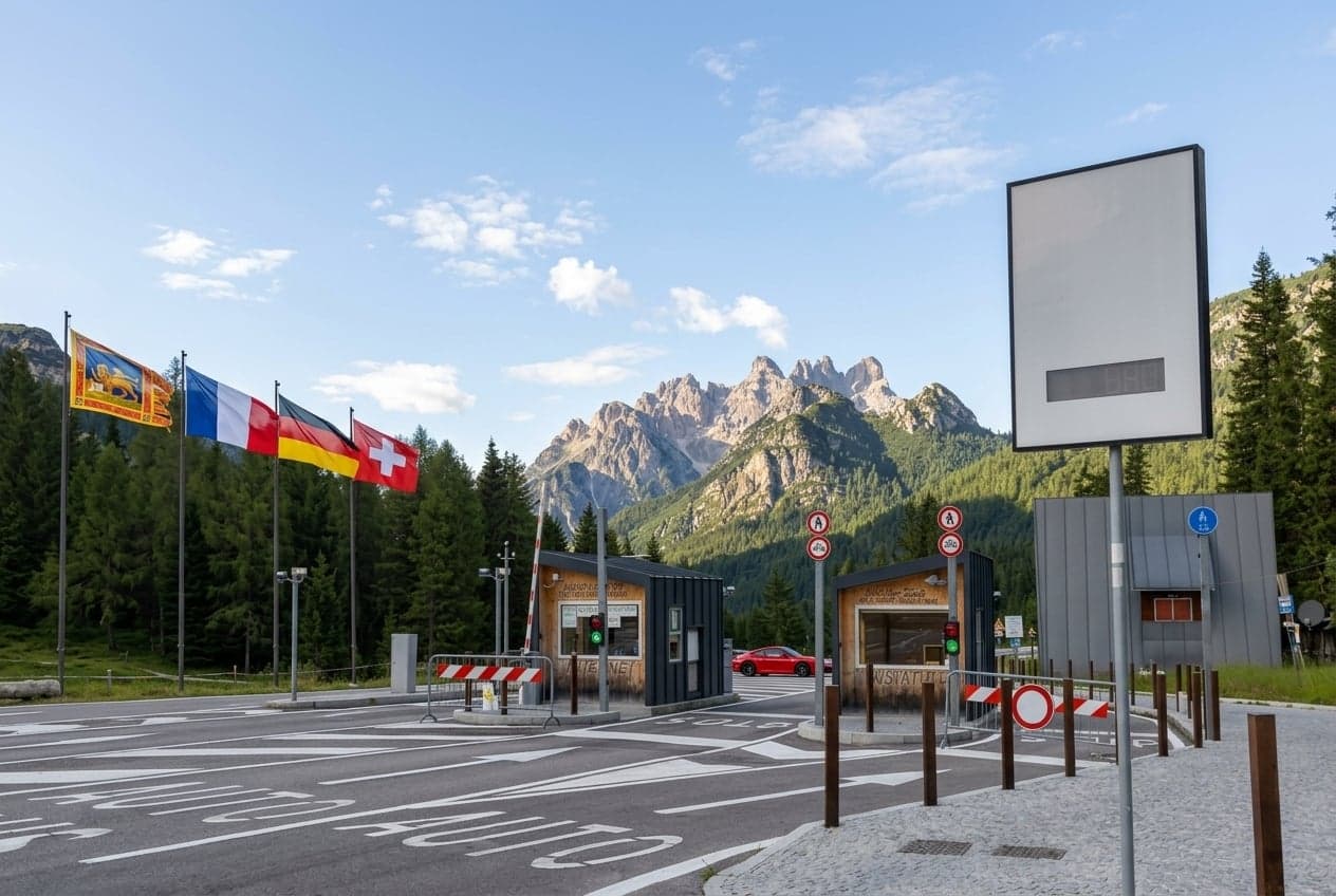
Here is what the toll costs and the fine print that trips people up:
| Rule | Detail |
|---|---|
| Car / motorcycle / camper | €40 / €26 / €60 |
| Ticket validity | 12 hours from your booked entry time |
| Overstaying | Automatic exit penalty: double the rate |
| Plate change | Editable once, then locked at 23:59 the day before |
| Cancellation | Refund only if you cancel at least 5 days ahead |
| Disabled visitors | Free, but you still book and register a plate |
The reservation only gets you to the gate; the crowd is a separate fight. In peak July the lot fills early in the morning - the sign at the Misurina turnoff flips to full - and once it does, that day is closed until the turnover.
Two arrival windows slip past it: reach the gate before the early rush builds, or come back for the afternoon. Spaces start reopening around 13:00, as the dawn hikers drive down, and the safest late window starts around 15:30 - no line at the gate, the morning crowds already thinning, the towers lit by afternoon light for the walk.
Booking has its own quirks. Slots appear to release about 30 days out rather than for the whole season at once (a pattern visitors report, not a posted rule), so with fixed dates, watch the portal a month ahead and take your day the moment it opens. And book the earliest slot you can live with: your reserved time is when the clock starts, so a mid-morning booking quietly eats the rest of your day.
Reserve on the official municipal portal, in English:
Tre Cime parking reservation portal (auronzo.info)
The reservation is the one thing on this trip I never leave to chance. Everything else up here you can improvise a little; this you cannot, and I have watched more than one group lose a morning to a barrier that would not lift. Book the date the moment it opens, enter the plate carefully, and the hardest part of the day is behind you before you have left home.
⚠️ Warning
No reservation means no entry - the gate turns you around, period. In peak July the lot is full by 7:30, so plan to clear the gate before 6:00, come after 13:00 when spaces start reopening, or skip the drive and ride a shuttle up.
One thing the toll does not buy is a full day and night. Your ticket covers a set window from the time you booked, not a flat day pass, so anyone who parks overnight and rolls out the next morning is charged again at the exit - a surprise most people meet only on the way down. Sleeping in the parked vehicle is allowed, but the moment you set up camping gear - a chair, a table, an awning - you are looking at a €100 - €500 fine.
Getting there without a car: buses, shuttles, or a guided tour
Coming up to the peaks without a car means stitching together more than one bus, and the buses belong to different networks that don't talk to each other. Three services matter: the 444 and the Tre Cime shuttle run all the way to the top, at Rifugio Auronzo, while the 445 gets you only as far as Dobbiaco. Shuttle 444 climbs the whole way from Dobbiaco, picking up along the road at Lago di Dobbiaco, Lago di Landro and Carbonin, the junction below Misurina. The Dolomiti Bus Tre Cime shuttle runs the short final leg up from Misurina itself. Bus 445 links Cortina to Dobbiaco, where you change onto the 444 for the climb. Working out which app sells which ticket is the part that quietly eats an afternoon of trip planning.
| Service | Route | Season / hours | Fare | Pre-book? |
|---|---|---|---|---|
| Shuttle 444 | Dobbiaco to Rifugio Auronzo | May 31 - Oct 11; departure times on the booking site | €16 one-way, €22 round trip | Yes, online only |
| Tre Cime shuttle (Dolomiti Bus) | Misurina to Rifugio Auronzo | Daily from May 30, end date unpublished; 07:40 - 19:15 | €10 per person, per day | No, tap onboard |
| Bus 445 | Cortina to Dobbiaco | Every 2 hours, 08:05 - 19:05; current timetable valid to Dec 12, 2026 | Single regional ticket | No, pay onboard |
The 444 is the one you have to arrange ahead: it takes online reservation and payment only, with no paying the driver, and once you've booked, save the PDF ticket to your phone rather than trusting the emailed link, because the QR code won't load at the stop, where there's often no signal. Children ride the 444 for €12, and a muzzled dog for €12. One quirk worth knowing if you're driving partway: the 444 will pick you up at Carbonin, down at the junction, but it isn't allowed to board anyone in Misurina village itself. The Tre Cime shuttle and the 445 you simply get on and pay for onboard, though the shuttle takes a tapped card only, never cash. Leave real slack for the trip down, too: by late afternoon the crowd waiting for the downhill buses at Rifugio Auronzo backs up badly, and missing one in the cold wind is a miserable way to end the day.
Reaching the Dolomites in the first place - the long haul in from Venice or Milan - is a trip of its own, best sorted before you get anywhere near these mountain buses.
Book and check the official timetables here:
Shuttle 444 tickets, Dobbiaco to Rifugio Auronzo (drei-zinnen.bz)
Tre Cime shuttle from Misurina (dolomitibus.it)
Bus 445 Cortina to Dobbiaco timetable, PDF (suedtirolmobil.info)
If coordinating the gate, the transfer, and the route on your own sounds like more moving parts than you want on a trip you flew a long way for, a guided day tour folds all of it into one booking, and someone else owns the reservation, the drive, and the walking route. Look for one that leaves from your base in Cortina or comes up from Venice, keeps the group small, and states plainly that the parking reservation is included, so you're not solving the gate a second time.
If you'd rather have your own wheels for the wider region, you'll be renting at the airport, most likely Venice (VCE) or Treviso (TSF); most people who drive the Dolomites do exactly that, since the trains stop short of the trailhead valley - the nearest railheads are Dobbiaco and Calalzo, a bus ride below the peaks. Price the full insurance upfront instead of gambling on the counter upsell, and remember the car doesn't get you past the gate on its own: you still need the license-plate reservation for the toll road, same as any driver.
Rent a car at Venice Marco Polo
Price the full insurance upfront - and the car still doesn't get you past the license-plate gate
The loop: walk it counter-clockwise to where the peaks appear
Once you're actually at Rifugio Auronzo - past the gate, or off the shuttle - the day comes down to one decision, and it isn't a hard one. Step out of the car and the famous towers aren't in front of you. What you're looking at is the bulk of the massif from behind, the broad, undramatic side that happens to face the parking lot, while the sheer north faces from the postcards are hidden around the far side. This is why the lot empties out so fast: the view everyone drove up for is behind the massif, out of sight, and nothing at the parking lot gives it away. The towers only turn to face you if you walk around them. Go counter-clockwise - out on trail 101 toward Rifugio Lavaredo, back on 105 - and the faces come up in front of you as you walk, instead of over your shoulder behind you. The distance is identical either way; only the order the views arrive in changes.
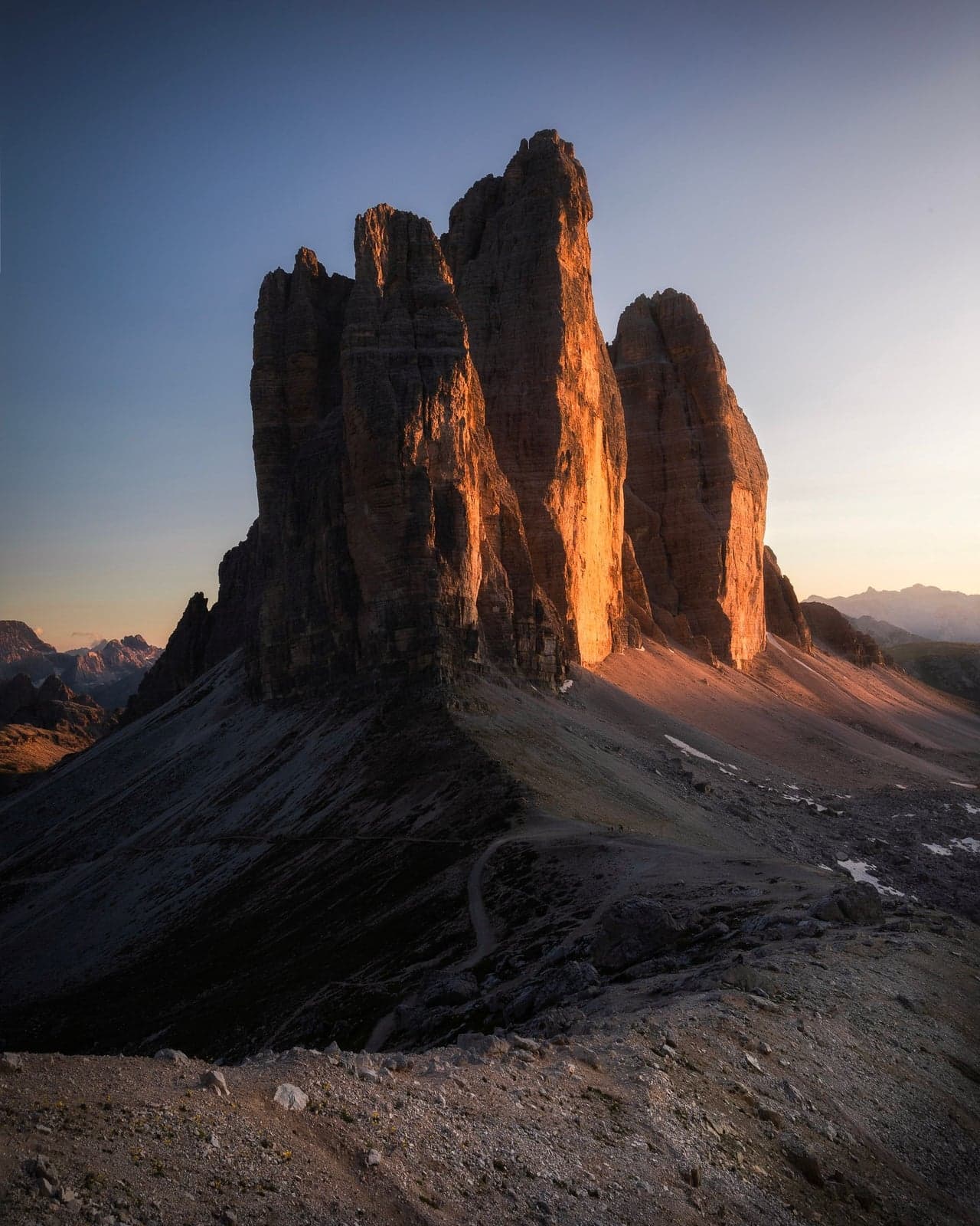
The turn comes at Forcella Lavaredo, the notch in the ridge where the trail finally tops out. For most of the walk in you have the towers' bulk beside you and not much ahead of you. Then the saddle opens and the three north faces stand up in front of you in a single line, sheer, with range after range of mountains stacked behind them to the horizon.
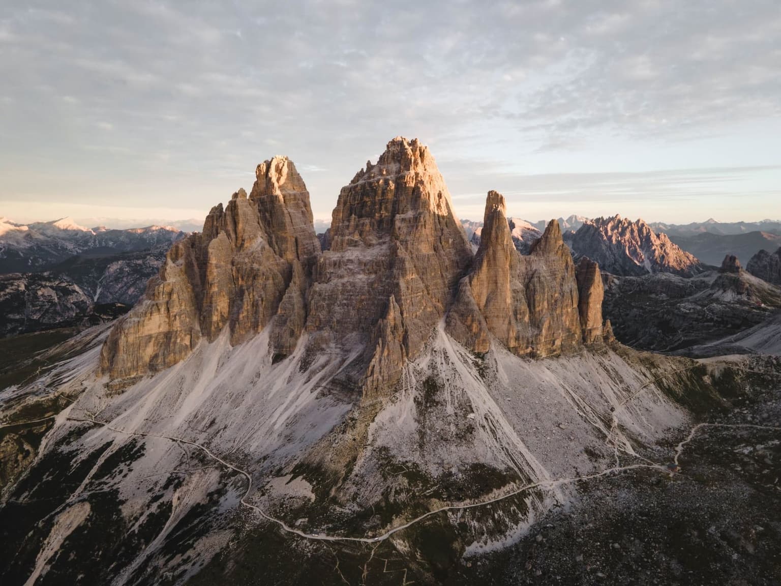
The loop itself is not a big day by Alpine standards: about 10 km, somewhere between 350 and 500 meters of climbing, three to five hours at a steady pace, all starting on trail 101 from Rifugio Auronzo. It earns its moderate rating honestly - there's nothing technical on the classic circuit - but moderate here still means real hiking boots, not the sneakers you see people turning back in.
You don't need the full circuit to get something out of the day, either. The wide gravel track that runs from Rifugio Auronzo toward the little chapel, the Cappella degli Alpini, is graded gently enough that slower walkers, or anyone nursing bad knees, can follow it out to a point and still stand beneath the towers - the easiest way to touch the landscape without committing to a three-to-five-hour day. It's the far side of the loop, beyond Forcella Lavaredo, that turns rough and narrow. Timing matters too: into late spring, trail 105 can still be buried in wet snow, and the steeper pitches near the top get genuinely dangerous without microspikes - the strap-on traction cleats that turn an ice slope back into a path.
💡 Tip
Walk the loop counter-clockwise: out on trail 101, back on 105. Don't line up your photos at the parking lot - the postcard north faces are about 45 minutes along the trail, at Forcella Lavaredo.
Clockwise doesn't waste the day, the Cadini di Misurina side trip waits for you either way, but it holds the best moment back until the end, and this is a view you want early, while your legs and your camera are still fresh.
Rifugio Locatelli, the WWI bunkers, and the side views
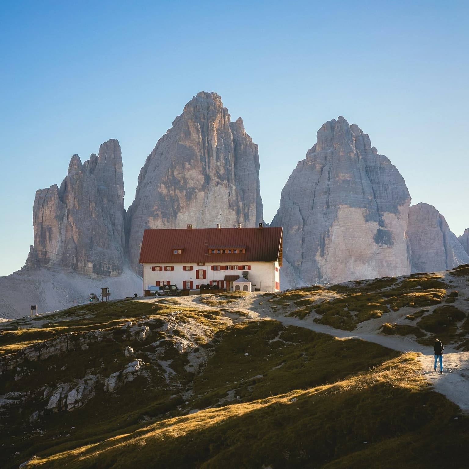
Keep going past Forcella Lavaredo and the trail drops down to Rifugio Locatelli - Dreizinnenhütte on the German-language signs - which sits directly opposite the north faces. This is the hut in the postcard: the terrace in the foreground, all three towers lined up behind it across the valley. It is also the loop's social heart, which is a polite way of saying it is mobbed at midday. Come through in the middle of the day and you can wait 40 minutes in line for a strudel while every table on that terrace is taken. There is no free tap water here - the hut sells bottled water at about €3 a liter - so fill your bottle before you start rather than pay mountain prices at the busiest point of the walk. Locatelli runs its 2026 season from June 27 to September 27; show up outside that window and the hut is shut.
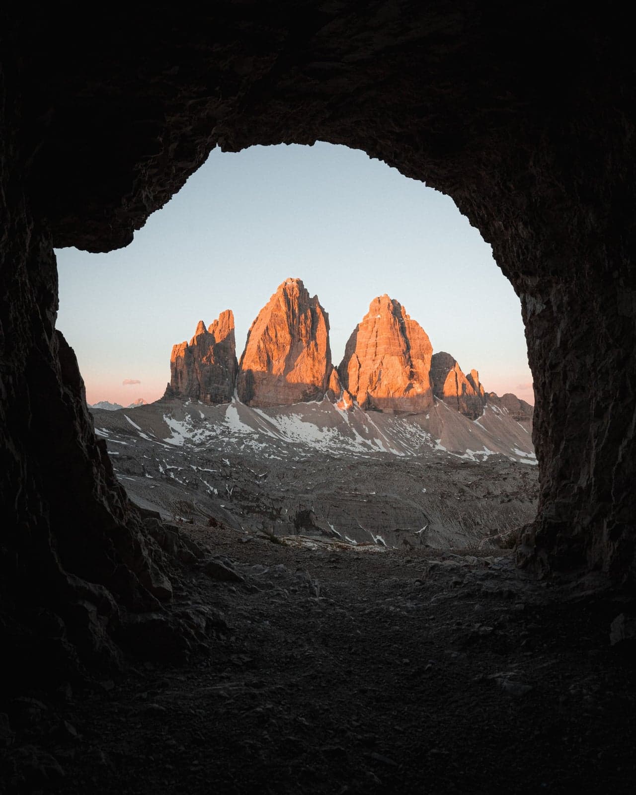
The payoff most people walk right past is behind the hut, not in front of it. A short climb - about 15 minutes up the slope behind Locatelli - brings you to the old bunkers on Sasso di Sesto, positions cut into the rock during the First World War, with window-like openings hacked straight through the stone. Frame the three towers through one of those openings and you get the same head-on view as the crowded terrace below, minus the crowd, because almost nobody bothers with the climb up. It costs nothing, and it is the closest thing this loop has to a private viewpoint.
The Cadini di Misurina viewpoint: a second postcard, 35 minutes off the loop
There is one more view worth knowing about, and it is not on the loop at all. From Rifugio Auronzo, trail 117 runs south about 35 minutes to a natural balcony looking straight into the Cadini di Misurina - the cluster of needle-thin spires that turns up on nearly as many Dolomites postcards as the Tre Cime do. It is a there-and-back detour rather than part of the circuit, so it is the first thing people cut when they are tired. Which is the argument for walking it first, before the loop, while you still have the legs to enjoy arriving.
Finding the start is the only fiddly part. From the Auronzo hut's terrace, go down the paved steps to the road; the trail sign stands right there, pointing south toward Rifugio Fratelli Fonda Savio.
What the photographs hold back is how thin the last of it is. The viewpoint sits on a narrow rock spur that branches left off the main trail, the path running along its spine with the ground dropping away on both sides. The spur runs out and there is nothing in front of you - the whole cirque of spires stands across the gap, and the mountain everybody drove up here to see is somewhere behind your back. It is a walk and not a scramble, but it is an airy one - worth skipping if you dislike heights, and worth saving for a dry day, because that spur is no place to test your footing on wet rock. Come at sunset and you will share it with a row of tripods and somebody's drone.
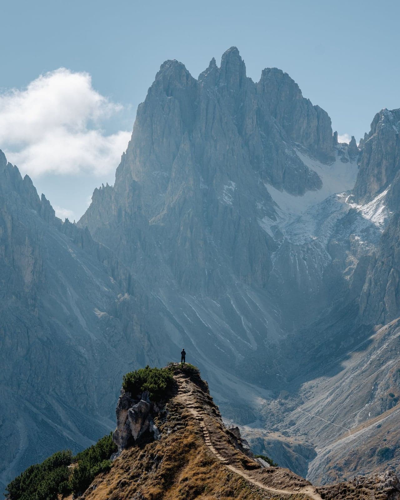
The viewpoint is also where the casual walker turns around. Past it the same trail becomes the cable-secured Sentiero Bonacossa on its way to Rifugio Fonda Savio - closer to a via ferrata than a hike, for equipped and experienced hikers only.
When to go: time of day, storms, and season
The trail runs on a daily rhythm, and the two good windows sit at opposite ends of the day. At dawn the loop is nearly empty and the low sun rakes across the towers while the valleys below are still in shadow, the version most people never see, because they're still at breakfast. By late morning it's a slow-moving line, and midday at Locatelli is the crush in full. The other window is the evening, and it pays off differently: the late start still slips the gate line, but the reward is the sun going down over the meadow at Malga Langalm and the headlamp walk out in the dark. If I had one morning here I'd take the dawn start; with only an afternoon, the late one.
What you cannot do is split the difference and start at noon. On summer afternoons the heat builds into thunderstorms that break over the high, open ground, where there's no tree and no hut to duck under. One hiker who set off at midday got caught in violent hail right at Forcella Lavaredo at 14:30, out on the saddle with nowhere to go. The exposed stretches are the ones with the biggest views and the least shelter.
The season splits into three, and which one you land in decides everything from the crowd to whether the road is open:
| Season | Crowds | Road & light |
|---|---|---|
| Peak summer (Jul - Aug) | Heaviest; lot full by early morning | Road open, long warm days |
| Shoulder (Sep - early Oct) | Thinner, but weekends still busy | Usually open, crisp air, low sun |
| Late season | Near-empty | Road may be shut, first snow, short days |
The toll road runs, in a normal year, from late May - late October, but the exact opening shifts with the snow year to year, so a shoulder-season trip hinges on checking the official portal first. And temper the go-in-fall plan: even a mid-September Sunday can run jam-packed up here, so shoulder season buys you quieter, not empty.
⚠️ Warning
Afternoon thunderstorms hit the exposed ridges with nowhere to shelter. Be off Forcella Lavaredo by early afternoon, or start late enough to walk the loop in the calm of the evening.
If you're building more than a single day around these mountains, the region's other timed-entry icon pairs with it naturally: Lago di Braies runs on the same playbook, reserve the slot ahead, arrive at dawn, so the two headline days slot onto one multi-day base without either becoming a scramble.
Where to sleep to be first at the gate
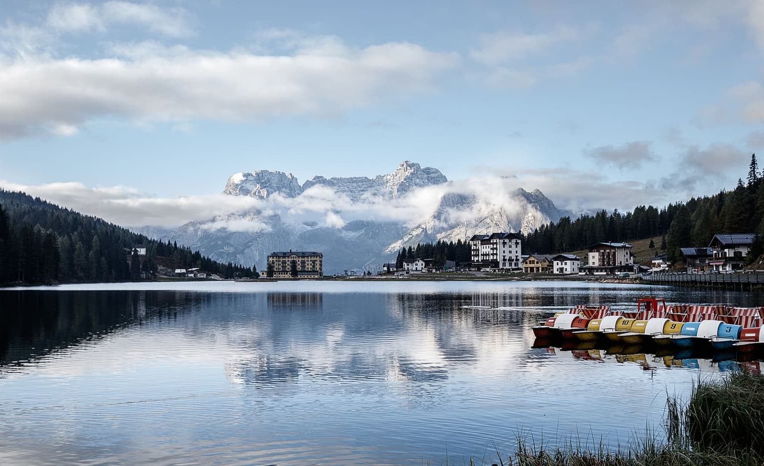
The surest way to make a dawn start painless is to close the distance to the gate before you ever set an alarm. When the lot fills by mid-morning in high summer, a bed an hour or more down the valley means a pre-dawn wake-up and, often enough, a wasted drive anyway; a room close to the trailhead turns that grim start into a short, sane drive. Four bases put you within range, trading proximity against how much town you get in return.
| Base | Getting up to the peaks | To the trailhead |
|---|---|---|
| Misurina | At the foot of the toll road; drive up or ride the Tre Cime shuttle | 7.5 km |
| Auronzo di Cadore | Drive up the toll road | 25 km |
| Dobbiaco | Shuttle 444 starts in town, and it's on the rail line for car-free trips | 27 km |
| Cortina | Bus 445 to Dobbiaco, then the 444, or drive | 22 km |
Misurina sits closest and puts you at the gate first, which makes it the pick if beating the morning fill-up is the whole point of the trip. Dobbiaco is the one to choose if you're arriving by train and going car-free, since the 444 shuttle leaves from there. Cortina buys you a proper town for the evening - restaurants, shops, the widest choice of beds - at the cost of a longer morning drive. Given the choice I'd stay in Misurina and take the extra twenty minutes of sleep. The most literal version of sleeping close is skipping a room altogether: overnighting in a parked car at the trailhead is allowed, within the same toll rules, and it leaves you first on the trail at daybreak.
Whichever base you land on, book early - the good, close rooms go the way the parking slots do - and screen for two things: a cancellation policy you can walk away from if the forecast turns, and an early breakfast, or the freedom to skip it, since a dawn start has you leaving before most hotel kitchens open. And if you sleep light, ask for a quiet-side room.
On the mountain: water, toilets, signal, and dogs
The rifugi look like a safety net - four huts where you can buy lunch and a bed - but leaning on them at midday is how a good walk turns into a lot of standing around. Carry your own water and enough food to get around the loop: the huts sell water by the bottle rather than pouring it free from a tap, and the lunch counters back up badly once the crowd lands. The other line worth beating is the restroom at Rifugio Auronzo, which at the busy start of the day can run 45 minutes - exactly when you'd rather be walking. Go before you leave your room, or the moment you reach the trailhead, ahead of the crowd rather than behind it.
Signal is the thing that quietly catches people out. The north side of the loop, the stretch between Rifugio Locatelli and Malga Langalm, has no cell coverage at all - not weak, none - so a phone that's your only map goes dark exactly where the trail is emptiest. Download an offline map, AllTrails or Maps.me both do the job, over hotel Wi-Fi before you set out. Don't count on a data plan or a travel eSIM to bail you out either: there's nothing to connect to up there, and no amount of data conjures a signal that isn't there.
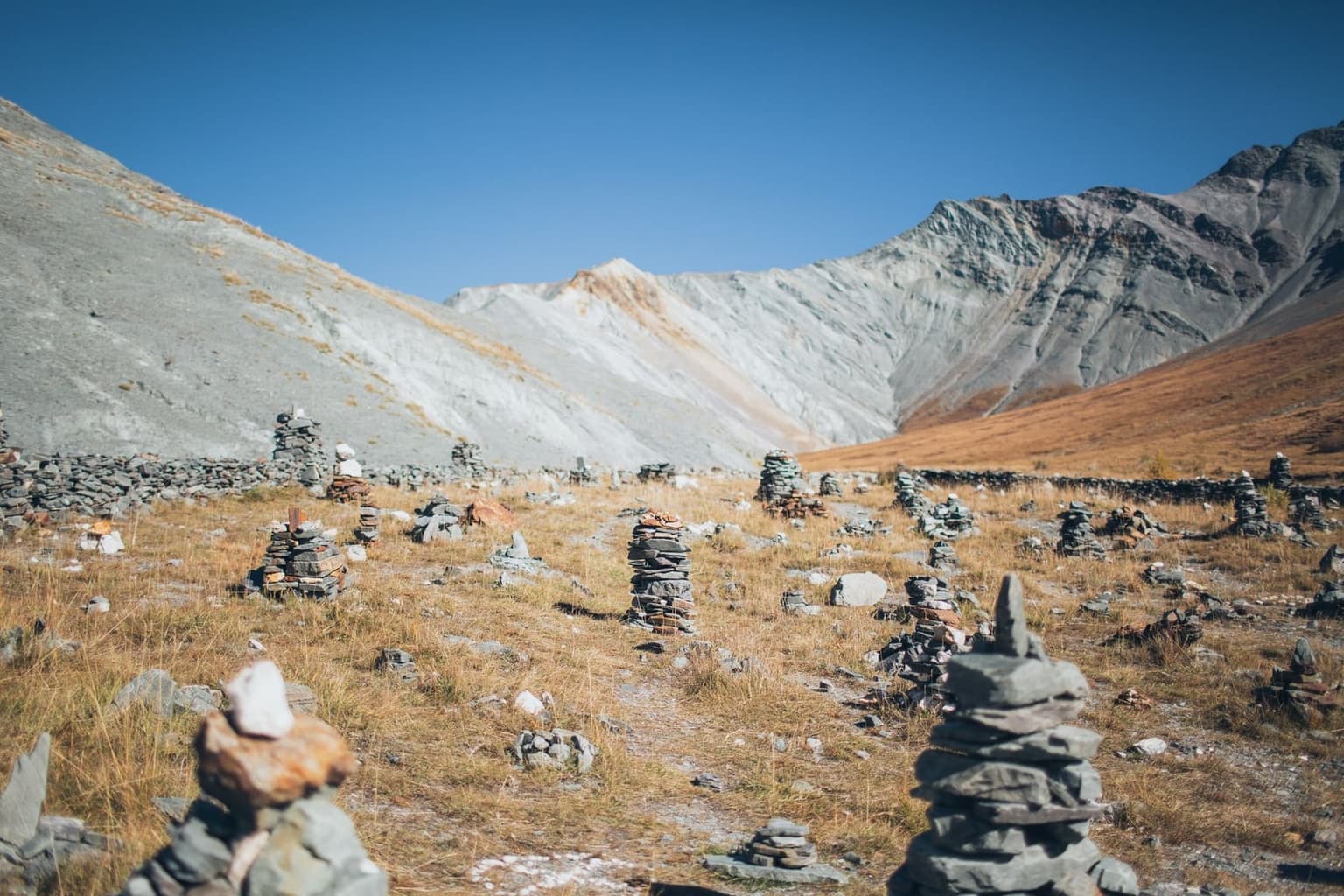
Dogs are welcome on the loop; keep yours leashed, since the paths pinch narrow in places and the crowds are thick. If you're riding the 444 shuttle up, it needs a muzzle too - the one detail people forget until the driver points at it. And one last thing, closer to a plea than a rule: the meadows up here are increasingly studded with little stacked-rock towers that passing hikers build and leave, and they clutter the exact foreground everyone climbed up to photograph. Admire them if you must. Just don't add another.
⚠️ Warning
No free tap water on the mountain and no cell signal on the loop's north side. Carry a full bottle and enough food for the circuit, and download an offline map before you leave Wi-Fi - the quietest part of the trail is also where your phone stops working.
Is Tre Cime di Lavaredo worth it?
It is, but the mountain won't do the work for you. Everything in this guide comes down to two decisions, and getting either one wrong is how people end up disappointed by one of the best day hikes in Europe. Win the gate first: reserve the parking plate or the shuttle, and time your arrival for the quiet edges of the day rather than the mid-morning crush. Then walk the loop counter-clockwise, as laid out above.
The gripes you'll read are all real. The lot fills before breakfast, the huts back up at midday, and the rock-stacking in the meadows has not slowed down. None of that is invented, and none of it is fixable on the day. What it is, though, is entirely dodgeable in the planning: the crowds thin at the hours nobody wants to set an alarm for, and the postcard view was never where the crowd was standing anyway.
Do those two things and the payoff is not in doubt. You come around the saddle, the three towers stand up in a line, and the logistics you sweated over stop mattering all at once. It is the walk whole Dolomites trips end up being remembered by.
Frequently asked questions
- Do you have to reserve parking for Tre Cime di Lavaredo, and how far ahead?
- Yes. The toll road up to Rifugio Auronzo is license-plate-reservation only, so no booking means no entry, and in July the lot is full by 7:30. Slots seem to release around 30 days ahead rather than all at once, so check the official portal often and book the moment your date opens.
- How long is the Tre Cime loop, and how hard is it?
- The classic loop is roughly 10 km with about 350 - 500 m of climbing, three to five hours at a moderate pace. There's nothing technical on the standard circuit, but it's real mountain trail underfoot, so wear proper hiking boots rather than sneakers.
- What's the best time of day and year to hike Tre Cime?
- Start at dawn or from about 15:30 onward, when the mid-morning crowds have cleared and the light is at its best. The road runs roughly late May - late October; in high summer the real hazard is afternoon thunderstorms on the exposed ridges, so plan your walk to be off the high ground by then.
- Can you visit Tre Cime without a car?
- Yes. Shuttle 444 runs from Dobbiaco up to Rifugio Auronzo, booked and paid online in advance, and the Dolomiti Bus Tre Cime shuttle climbs the short leg from Misurina. Coming from Cortina, the 445 links you north to Dobbiaco to pick up the 444.
- Are dogs allowed on the Tre Cime loop?
- Yes, dogs are welcome on the loop as long as they're leashed, since the trail pinches narrow and the crowds are thick. If you're riding the 444 shuttle up, your dog also needs a muzzle for the trip.
None of this is a trip you want to improvise at the gate, but none of it is hard once you have decided to plan it. Get the booking and the direction sorted before you leave home, and the only thing left to leave to chance is the weather.