George Mandrovny
What the Sorapis hike actually is - and the one thing that decides your day
Lago di Sorapis is a glacier-fed basin at about 1,923 m, reached only on foot, out and back from Passo Tre Croci: a bit over 12 km with something like 600 m of climbing. Allow 5 - 6 hours, not the four you will see quoted - what eats the extra time is not the climb, it is the wait where the path narrows to a cabled ledge and two-way traffic stops dead. Be at the pass before 08:00, which is when the roadside bays fill in summer, or ride the 08:00 Line 51 bus up from Cortina: the summer line runs daily from June 8 to September 9, 2026, so a car-free day genuinely works while it does. The trap is that this is a hikers' path with fixed cables, a metal ladder and real drops, not a stroll, and in a dry year the famous turquoise can be a fraction of what the photos show.
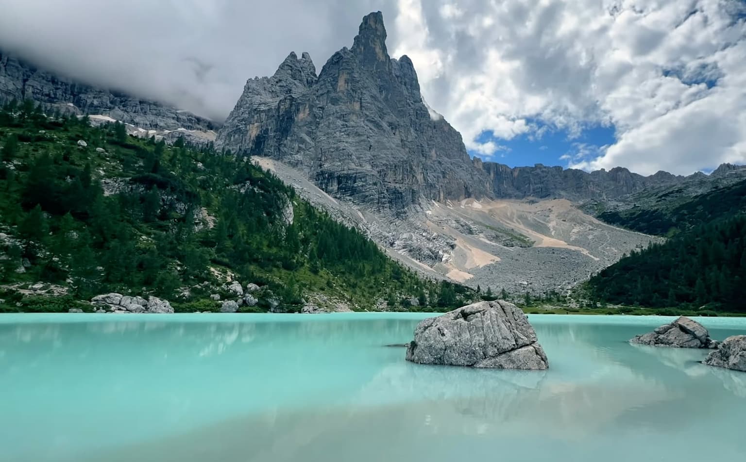
People come up here for one thing, and it is not the exercise. The water is a flat, opaque turquoise that does not behave the way lake water is supposed to: it looks poured rather than filled, and it sits in a bowl of pale gray scree with the Sorapis wall going straight up off the far shore.
Nothing about the place is gated. No ticket, no reservation, no lift, no road - which is the charm and also the problem, because there is no version of this day that takes less than the walk.
If I could staple one sentence to every Sorapis photo on the internet, it would be that the hard part is not the climbing. Three decisions follow from that, and everything else up here is downstream of them: what time you start, whether the exposed section is for you at all, and how much water will be in the basin on the day you show up. The clock comes first, because it quietly decides the other two.
Start time decides the day: parking at the pass, and the bus that actually works
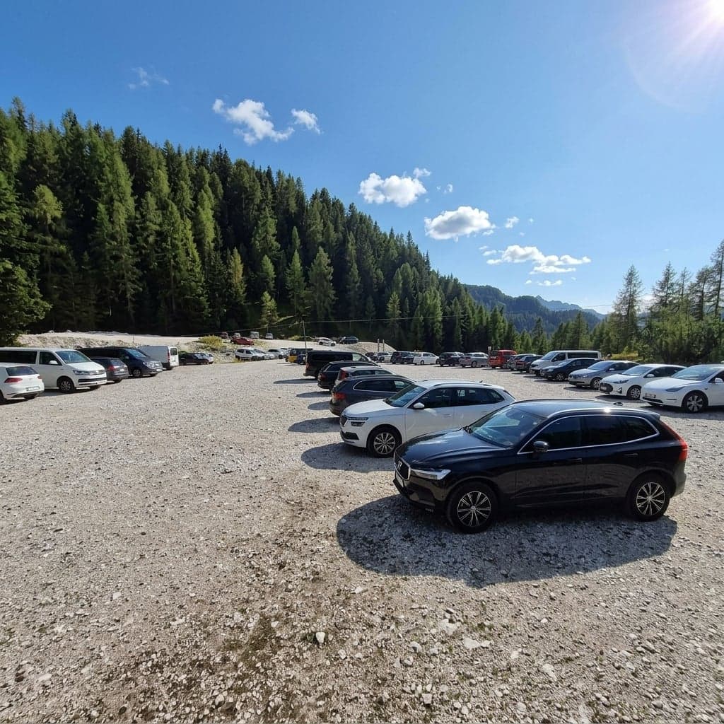
There is no parking lot at the trailhead. What Passo Tre Croci has is free bays along the roadside, the lot belonging to Hotel Passo Tre Croci, and a gravel lot signed "Parcheggio per Sorapis" a little further along the road. In July and August all of it is gone by around 08:00 to 08:30; even in mid-June the overflow can already stretch 2 km down the road by 08:00. None of it is a rule you can plan against, only the consistent pattern of recent summers.
Which is why the bus is the answer I hand people first, and why it is worth being exact about it. Popular English-language guides send readers to a Dolomiti Bus 30 or 31, and that is wrong for this trailhead: the 30 is the Calalzo to Cortina line. The one that stops at Passo Tre Croci is Line 51, out of Cortina Scuole, which takes 23 minutes to climb to the pass before carrying on toward Misurina.
| Line 51, daily, June 8 - September 9, 2026 | Departures | Gap to plan around |
|---|---|---|
| Up: Cortina Scuole to Passo Tre Croci (arrives at :23) | 08:00, 09:00, 10:00, 11:00, 12:00, 14:00, 15:00, 16:00, 17:00 | nothing at 13:00 |
| Back: Passo Tre Croci to Cortina (arrives at :55) | 09:32, 10:32, 11:32, 13:32, 14:32, 15:32, 16:32, 17:32, 18:32 (last) | nothing at 12:32 |
Coming up after about 13:30, once the morning crowd starts vacating spaces, is a real move rather than a fantasy - but only with a car, only in high summer, and only with the last departure in the table in front of you. The walk does not get shorter because you started late. Set off at 16:00 to take an emptying space and you will be walking out in pitch dark by flashlight; even a 13:00 arrival in mid-October can find exactly one space left. Treat it as a fallback, never as the equal of an early start.
⚠️ Warning
This is a summer line, and the operator prints its own caveat under the schedule: "Gli orari possono subire variazioni", times may change. Check the current one the night before you go, and do not count on tapping a card on board - carry cash or buy the ticket in advance.
The timetable lives on the operator's own site: Dolomiti Bus's seasonal summer lines, Line 51 among them.
If you would rather own the clock than fit into it, a car is what buys the pre-08:00 window and covers the hole the schedule leaves in the early afternoon. Book the smallest one you are comfortable in, and take the version with insurance priced upfront rather than sorted out at the counter with a line behind you.
Rent a car at Venice Marco Polo
Insurance priced upfront - and it covers the early afternoon the bus schedule doesn't
Everything upstream of that - which airport you land at, whether you rent anything at all - is a separate decision, worked through in which airport to fly into, and whether you need a car at all.
Either way the day starts in the same place: a signpost at the pass where the path leaves the road and drops into the trees.
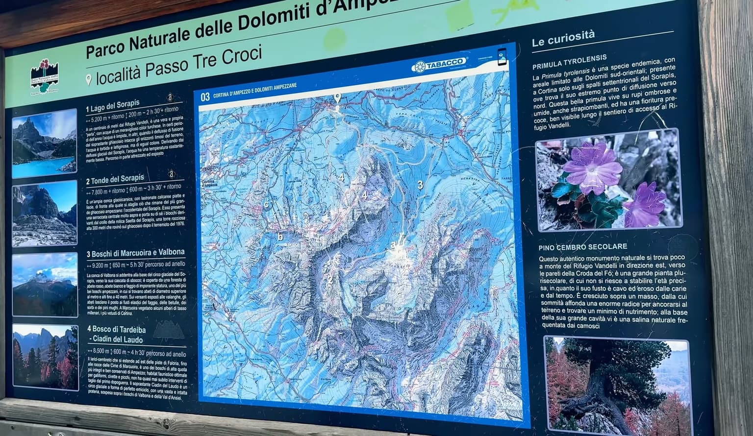
From there the walking is easy for a good while, which turns out to be the whole problem.
The route: easy forest, then the part that stops people
The track climbs through the forest, wide under spruce and larch, at a grade you barely notice, with the valley opening between the trunks every time the trees thin. The trail is signed 215 at the pass, and on the way up route-finding is not what makes the day long.
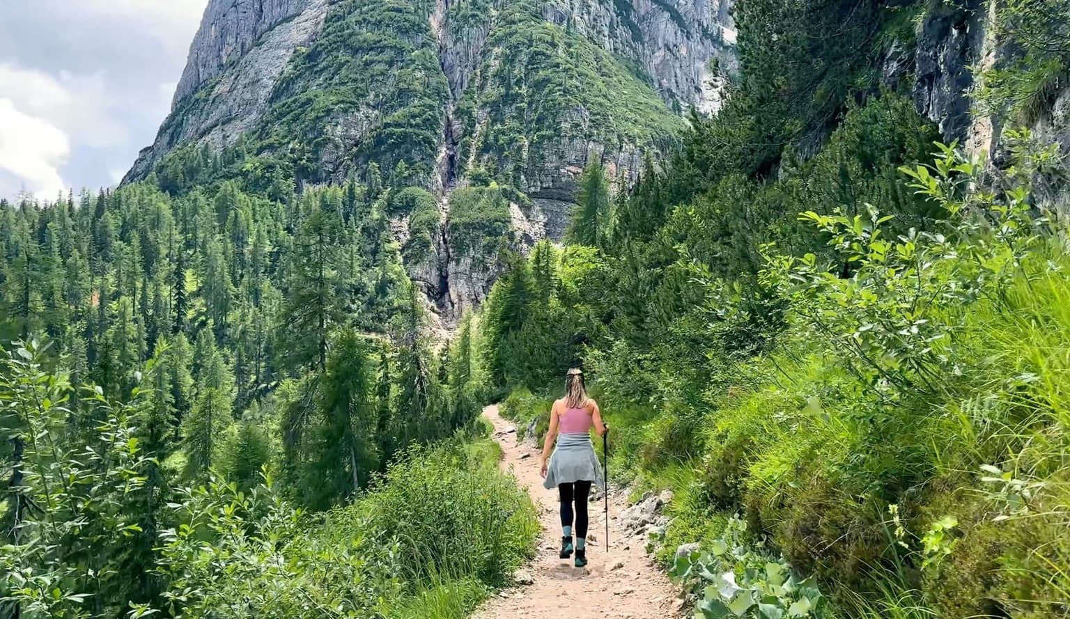
Then, without much warning, the trail changes character. The track ends and the route becomes a line cut across the rock: a stretch of scree, "a rocky spur equipped with a metal ladder", and "a short exposed stretch with a fixed rope (often slippery when wet)". Those are the regional tourism board's own words on its itinerary page, and the same page grades the route E, for hikers (the board's own grade, not an alpine-club ruling) - a marked path, not a via ferrata, with nobody expecting you to carry a harness.
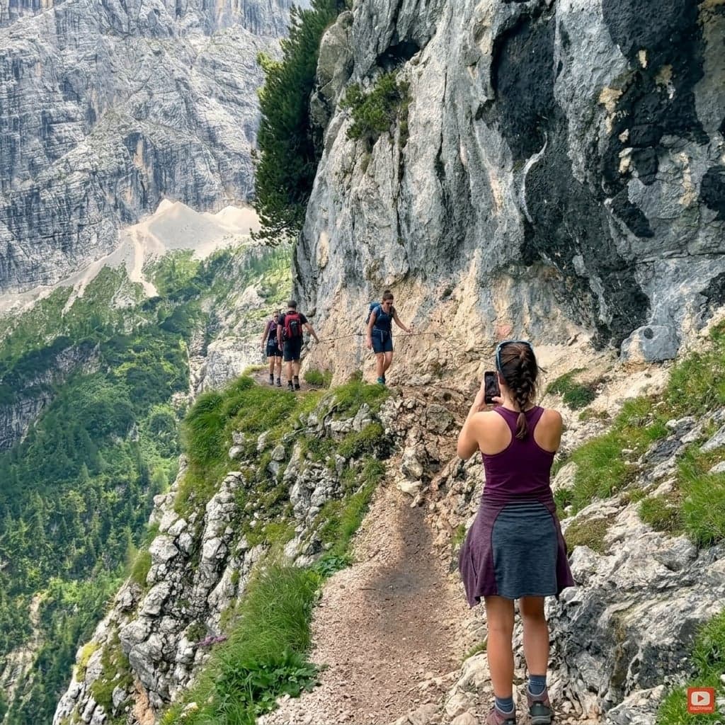
On the cabled sections the tread narrows to something like a meter, rock on one shoulder and air off the other. Two people cannot pass there, so traffic takes turns, and waits of a quarter of an hour or more are routine. All it takes is one person who stops: somebody looks down into the drop mid-ledge, freezes, and everybody behind them stands and waits. Others do the opposite and try to pass on the narrow parts, which is the one genuinely dangerous thing that happens up here.
If heights genuinely frighten you, I would not choose this trail as the place to test it. The exposed stretch is short and nothing about it is technical, but the drop is real, and a ledge with people stacked up behind you is a bad place to find out what your legs think about it. The other half of the problem is underfoot: every summer day, somebody walks up here in flat-soled sneakers.
⚠️ Warning
Boots with real grip, not sneakers - the limestone up here is polished smooth by traffic and slick when it is wet. On the cabled ledges, wait your turn instead of trying to pass, and never step off the path to let somebody by.
Then go back the way you came. There is a long way around, and the same tourism board page grades it EE, expert hikers. It is loose ground, scrambling, and real exposure - a different day in every way. The problem is that you do not have to choose it to end up on it - it gets taken by mistake, and that mistake finishes about two hours' walk from the car.
If you want the lake without making that call by yourself, a guided hiking day is the honest fix: somebody who knows exactly where the cable starts, and, on the tours that include transport, the parking problem taken off your hands. Look for a specific dated itinerary that names Sorapis and says plainly that it includes the exposed section, check the group size, and skip anything that stacks another famous stop onto the same afternoon.
How long it really takes, and the latest you can start
Every published number for this walk disagrees with the others, and the disagreement is more useful than any single figure. The tourism board's itinerary page gives an hour and 45 minutes to the lake. The park's own list of outings files it at four hours. Hikers report the sign at the trailhead saying two and a half hours one way, and the ones who timed themselves describe about two hours up, two hours down, and however long they sat at the shore.
None of them is lying. They are timing different things, and not one of them counts the standing still. Plan on 5 - 6 hours from the car door back to it, and treat anything quicker as a gift.
Then build the day backwards from the last way out.
| Allow for | Up on the 08:00 bus | Parked before 08:00 |
|---|---|---|
| Walking from | 08:23, when the bus reaches the pass | whenever you are laced up |
| At the lake | late morning | mid-morning, ahead of most of the traffic |
| Leaving the shore | in time for the 15:32 or 16:32 back | on your own clock |
| Hard deadline | the 18:32 down (the last one) | the light |
Those are allowances, not measured walking times.
Neither classic mistake here - the 16:00 start, the wrong turn onto the long way around - is a walking problem: the late start puts an ordinary 5 - 6 hour day into the dark by plain arithmetic, and the wrong turn leaves you not lost, just much further from the car than the afternoon allows. A late start does not make you slow. It removes the margin that absorbs a wait at the ledge, a wrong turn up top, twenty minutes too long at the water. So carry a headlamp even on a day you are certain will be short.
Which brings me to the plan I would most like to talk you out of. Italian press this summer describes Sorapis becoming a stop on a one-day photo circuit: Tre Cime in the morning, Sorapis in the afternoon. That is the 16:00 start, sold as an itinerary. Tre Cime is a full day with its own access to sort out, and what a Tre Cime day actually costs you in time is worth reading before you try to bolt the two together.
Get the clock right and the rest of the day belongs to what is actually in the basin when you arrive.
The lake: the color, and whether it will be there
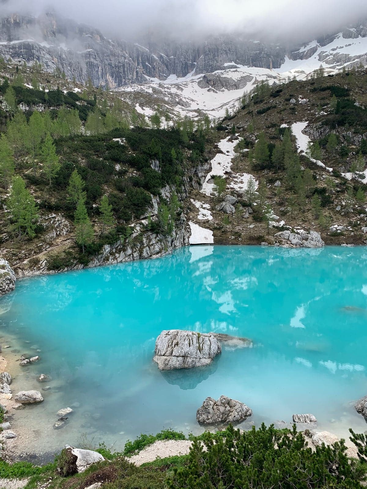
And then the basin opens in front of you, all at once. Up close the water has no depth to look into: the blue-green sits right at the surface, like paint that was never stirred in, and a step out from the edge the bottom is already gone. Snow lies in the gullies high on the wall above it, and the pale rubble around the shore makes the color look like somebody put it there on purpose.
That much the photographs get right: the bright milky blue is real, and it is more striking in person than any of them manage. What no photograph can tell you is how much water will be in the basin on the day you show up.
The color is rock, not light. The small glaciers in the cirque above grind rock to flour, meltwater carries it down, and the particles stay in suspension instead of settling out, which is why the water is opaque rather than clear and why it lands on that particular shade. The same arrangement explains the other thing the basin does. Nothing flows out of it on the surface: it fills from the ice above and drains downward through the karst, so the level you get is a running balance between what the glaciers are giving and what the rock is taking away. Normally that balance holds through the summer and tips when the cold arrives in the fall.
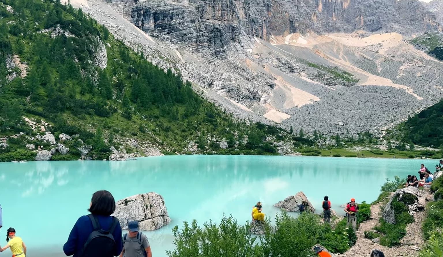
That is the pattern, and in 2026 it broke. In July the lake stood at minimum levels, and the manager of the hut by the shore - thirty seasons up there - said it was the first year he had seen it run dry that early; normally that happens in October, once it starts to freeze. Which means the line you will read on nearly every other page about Sorapis, that it empties in the fall and can be counted on all summer, is not something to plan a day around anymore. Check what the basin is actually doing in the weeks before you go: the hut's own site and recent dated trip reports are worth more here than any photograph taken in a good year.
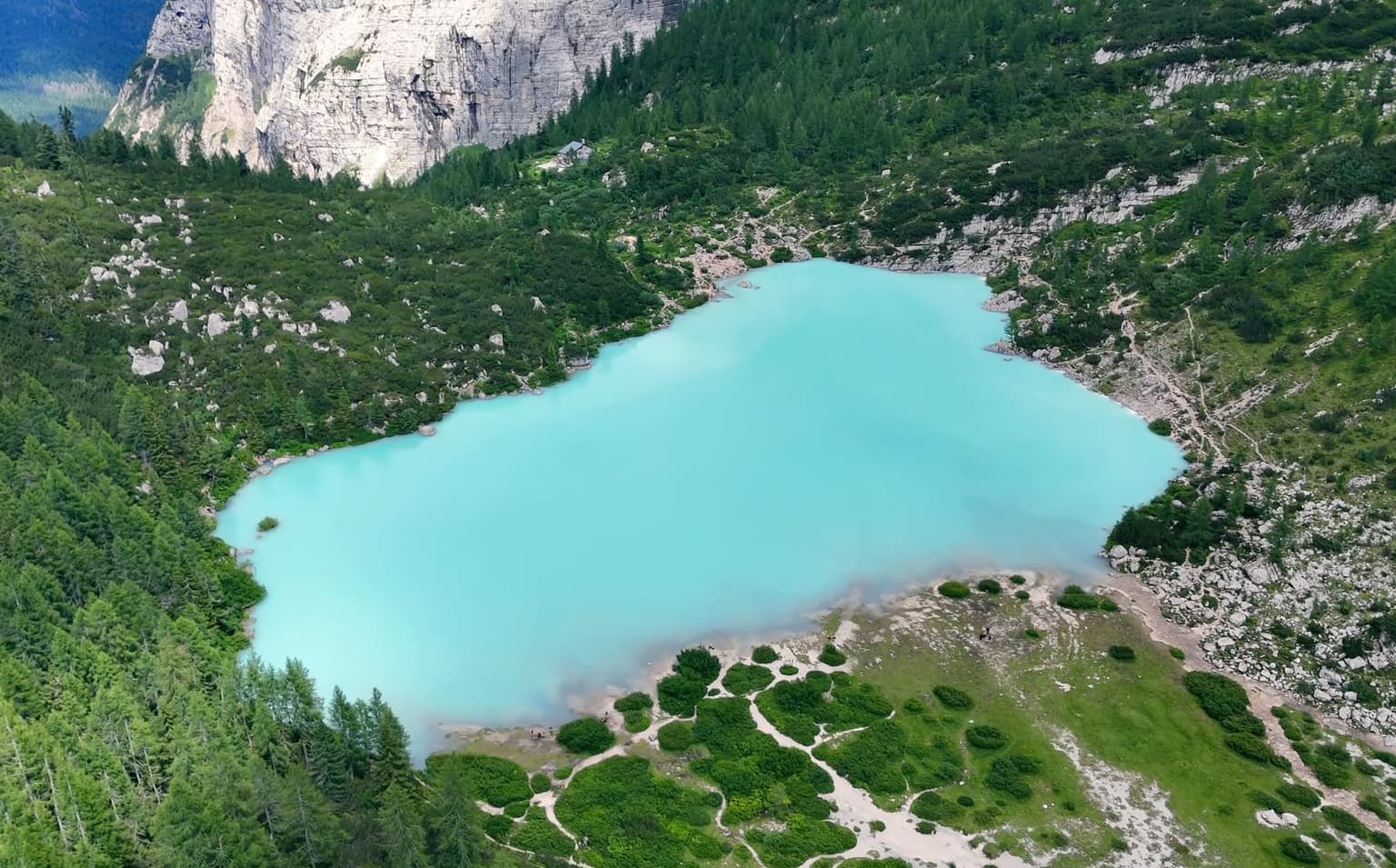
Light does the rest of the damage. In flat weather the water reads dull and milky rather than the color everybody came for, and by August 2025 the basin was already running low. Even a thin year is still beautiful - there is just less water in it.
What you walked up for is the color and the wall above it, and neither of those is a function of volume - but if a whole day is being spent on one specific photograph, the one already saved on your phone, know the odds before you set the alarm.
Either way you will be up there a while, and the shore comes with its own set of rules about what you can do and what you had better have carried up with you.
At the shore: the hut, the water, and the rules
A short way back from the water stands the only shelter on this route. Rifugio Vandelli is the shelter, the kitchen, the water point and the restroom for the whole trail, which is a lot of jobs for one building. Its 2026 season runs June 20 to September 20, with any earlier or later opening posted on the hut's own site; plan on cash only. A bed is a different matter: those get booked months ahead.
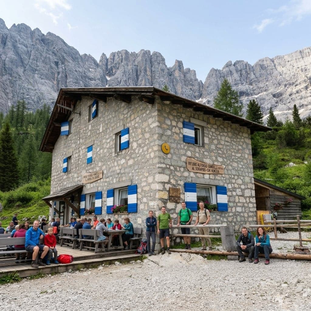
This summer the hut lost its own water. The springs feeding it ran dry, and its own notice says the public restrooms have been closed since July 13; there are no bottle refills either, and water is being flown up by helicopter. That is a sentence with a short shelf life: it may be fixed by the time you read this, and the hut's notices are where that will show first. Until then, treat the Vandelli as a place to sit down, not as a supply point.
Dates, notices and beds all sit on one page: Rifugio Vandelli's own site.
⚠️ Warning
Carry all the water you plan to drink, and go into the day assuming there is no restroom anywhere on it. Neither is something the hut can help you with this summer.
Food is the same story - there is nowhere else on the trail to buy any - and outside those three months the hut is closed and the route carries nothing at all: no roof if the weather turns, no water, no restroom, nobody to ask. Poles earn their place on the way down.
The question everyone asks about this lake is whether you can get into it. The honest answer is short: swimming is banned, and the sign right at the shore says so plainly - it's there to keep the water as pristine as it looks in photos.
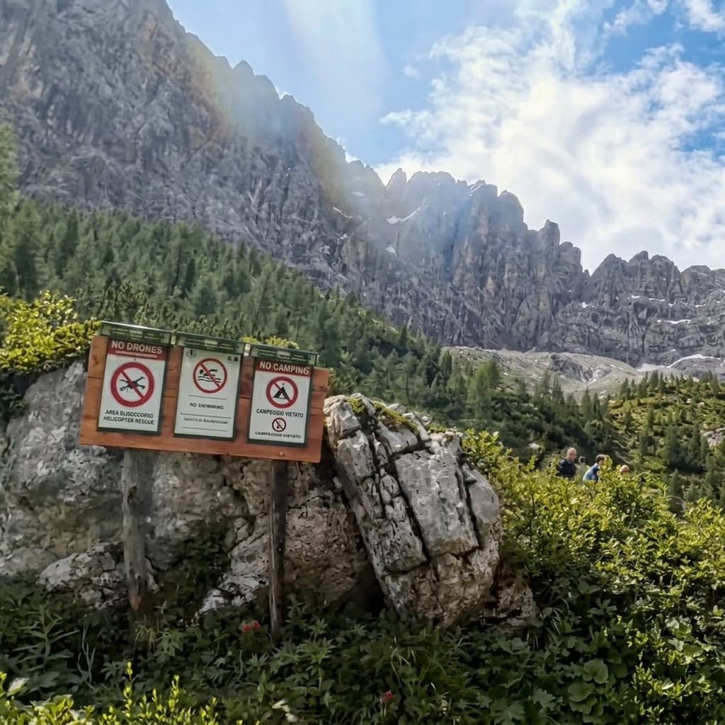
Drones are the other rule people arrive having read the wrong thing about. The park counts Sorapis among its own areas, and over park land a drone is prohibited as a matter of course unless you hold specific written authorization: requested by email at least four days ahead, with your pilot's certificate and insurance. Plan on needing it rather than on being outside the line.
The drone rule and its request procedure are a park document, in Italian: what is forbidden over park land, and how to ask for the authorization.
The rest of the park's rules are the short kind: no camping in tents or campers, no open fires, dogs on a leash. Hut staff say they collect paper, glass and plastic bottles off the ground every evening, and the reporters who found that paralyzed hiker on the ledge also walked the shore, where the bushes within 100 m of the water are full of tissue. Sort yourself out before you leave the pass, and carry out what you carried in.
Almost none of it is fixed, though. The hut, the water and the company you keep up there all move with the season.
When to go - and why it deserves its own day
Three things change with the season, and not on the same dates: whether snow is still lying on the exposed section, whether there is anything open at the top, and whether you can reach the pass without a car.
| Season | Trail | Bus | Hut | Water |
|---|---|---|---|---|
| Early June | Snow and ice can still lie on the ledges | Starts June 8; before that the winter schedule lists no route over the pass (drive, check the operator) | Closed until June 20 | Filling from the melt |
| High summer | Clear, with the longest waits at the ledges | Summer Line 51 daily (first up 08:00, last back 18:32) | Open, cash only | Historically fullest; July 2026 hit minimum levels |
| September | Quieter, with the light going earlier | Last day September 9; then the winter schedule publishes no line over the pass (drive; check the operator) | Open until September 20 | Usually still holding |
| October on | Early dark, nothing open if the weather turns | Summer line done; the winter schedule carries nothing over the pass (drive, check the operator) | Closed | Historically the year's lowest |
Hikers ask that first question every spring, usually in the first week of June: is the exposed section clear yet? Snow across a cut ledge with a cable through it is a different proposition from the same ledge in August. The bus catches people out at the other end of the year. It is a summer line and nothing else: once it finishes, the operator's winter schedule publishes no line whose route reaches Passo Tre Croci, so an October day means driving, and checking the operator.
In between, the weather keeps its own schedule: the forecast is worth something about a day out, not a week.
⚠️ Warning
Afternoon storms are the summer norm, and the cabled ledges are the worst place on this trail to be standing when one arrives. A storm can take the basin down about 18°F (10°C) in minutes, and light layers are no answer to that. Be off the exposed rock by early afternoon, and carry a layer.
Which is the argument for giving this hike a day of its own. To be parked before 08:00, or on the first bus, you have to be sleeping nearby. Cortina is the practical base; on the bus schedule Misurina is the nearer of the two, 12 minutes from the pass against Cortina's 23 - but those eleven minutes decide nothing about where to sleep, because the ride to the trailhead is a sliver of the morning and your evenings are the rest of the stay. Book somewhere that serves breakfast early, and take free cancellation - the storm you are planning around is exactly the kind of thing worth moving a day for.
Which town, and what fills the days on either side, is a question about the base rather than the trail: I go through choosing a base within striking distance of the trailheads and the other hikes worth a day. Whether this one is worth a day of yours comes next.
Is Lago di Sorapis worth it?
Yes, with three conditions, and you set all of them before you leave: be at the pass early, take the cabled section as the price of admission rather than a surprise sprung on you halfway up, and come to see the water and the wall it sits under rather than to find one particular waterline. Do that and it is one of the best days going in this corner of the Dolomites. Miss the first condition and you will spend a good share of it looking at the back of somebody's pack.
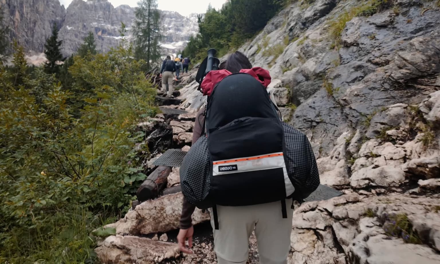
The numbers are not small, and they come from the one building up there that watches everybody go past. The manager of the Vandelli told the Italian press this summer that the lake takes something like 3,000 arrivals on a peak day, that June 2026 ran about 20% above the same month in 2025, and that at those numbers protecting the place is impossible - he is publicly floating turnstiles or a capped daily number. That is the hut's own count and the hut's own read, not a measured figure.
The blunter version: this is a beautiful place without people and a worse one with them, and that is the whole trade-off in one sentence.
So three people I would send elsewhere in these mountains, cheerfully: the one who cannot stand waiting on a crowded trail and will not start early, the one who already knows heights are a hard limit, and the one spending a whole day on one specific photograph in a season nobody can promise them. Everybody else should go. A few questions tend to come up right before people commit the day.
Frequently asked questions
- How long does the Lago di Sorapis hike actually take?
- Allow 5 - 6 hours start to finish, shore time included. The published estimates are not wrong; they just do not count the waiting where the path narrows to single file.
- Is the Lago di Sorapis hike dangerous if you're afraid of heights?
- It is a marked hikers' path, not a via ferrata: no harness, nothing technical. But it crosses ledges cut into the rock, with a fixed cable, a metal ladder, a drop on one side, and limestone that goes slick when wet. If heights are a real fear, this is not the trail to test them on.
- Can you get to Lago di Sorapis without a car?
- Yes, in summer. Dolomiti Bus Line 51 runs Cortina to Passo Tre Croci daily from June 8 to September 9, 2026: first bus up at 08:00, last one back at 18:32. Outside those dates the operator's winter schedule publishes no line over the pass, so plan on driving and check the operator first.
- Will there be water in the lake when I go?
- Not necessarily. The basin drains down through the rock rather than out of a stream, and in July 2026 it stood at minimum levels for the first time that early in the hut manager's thirty seasons. Check dated reports from the weeks before you go rather than photographs from a good year.
- Can you hike to Lago di Sorapis with kids?
- Sure-footed kids who walk a lot will be fine through the forest. The cabled ledges are the honest question, and only you can answer it for your own child; a carrier on that ground is a hard no.
So set the alarm. The ledge, the light and the level of the water are not yours to arrange; the hour you are standing at the pass is, and it decides most of the rest.