George Mandrovny
The map, and the four things it does not show
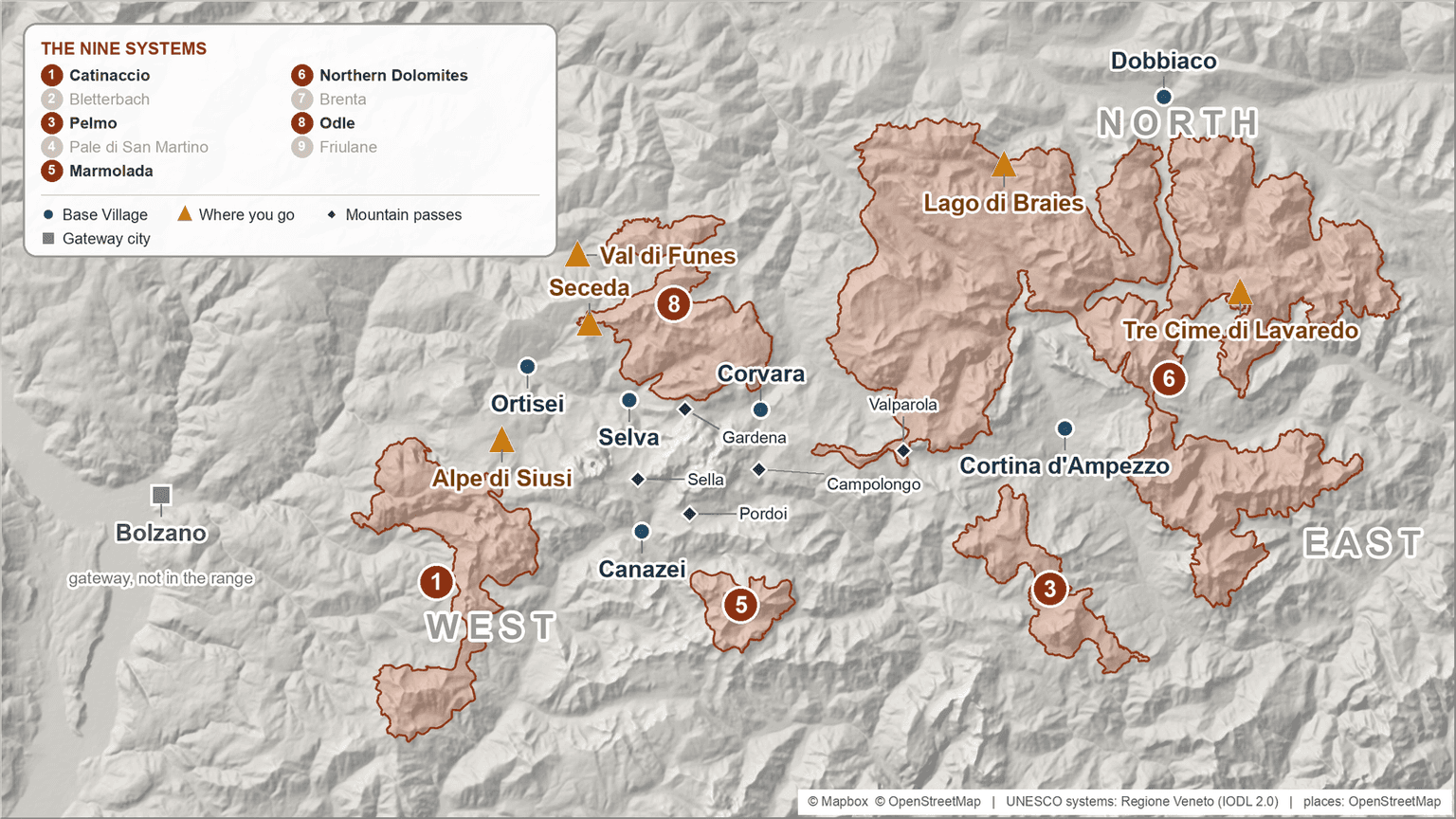
The Dolomites are not one mountain. They are nine separate mountain systems across five provinces in three Italian regions, and travelers base in villages in just three of those five. So the first move is picking which corner of this map your trip sits on. The trap is reading the range as one place: a hotel, a marquee sight and a day trip that turn out to be hours apart.
Four things the map does not show:
- 28 km over a pass runs about forty minutes; so does 36 km on the valley floor.
- Three transit networks and three road authorities run these mountains; none covers it all.
- The same road, plateau or village carries more than one official name: one place, or two?
- A village can look Dolomite in every photograph and sit outside the range on the tourism board's map.
Nobody finds this out while planning. They find it out on the third morning, halfway through a drive that was supposed to be a short hop between two valleys. You sleep in the valleys and look at the massifs: the valley is the unit, the rock above it the reward.
The west sits in the province of Bolzano - the South Tyrol valleys, Val Gardena and Alta Badia, with the Alpe di Siusi plateau standing above Val Gardena's floor, a piece of map with its own way up.
The north is the same province, strung along the Val Pusteria - Lago di Braies and the Tre Cime group hang off it, and the marquee point sits behind a booked, paid gate: the road up to Tre Cime.
The east is the province of Belluno, in Veneto - another region, another transit operator, another road authority, and the corner the eastern gateways reach most easily. Cortina d'Ampezzo is its town, covered in my Cortina d'Ampezzo guide.
Trentino holds Val di Fassa beyond the passes, on a third network. None of these borders is visible from a viewpoint; you meet them as an extra hour, or a ticket that stops working. So I plan a trip here the way I would plan island-hopping: which islands, in what order, and what the water between them costs.
Distances lie: what a crossing actually costs
In the Dolomites 28 km over a pass takes about as long as 36 km on the valley floor, which is why a crossing is priced in hours and not kilometers. Distances here are honest. Times are not, and the same crossing gets different answers depending on where you look. The times below are a mapping service's estimates, optimistic by construction.
| Crossing | Distance | Driving time | What it really is |
|---|---|---|---|
| Ortisei to Corvara | 28 km | 39 min | One pass, a 43 km/h average |
| Ortisei to Cortina | 65 km | 76 min | Two passes |
| Ortisei to Lago di Braies | 91 km | 87 min | Not a crossing, a loop around |
| Cortina to Lago di Braies | 46 km | 46 min | |
| Cortina to Dobbiaco | 32 km | 31 min | |
| Bolzano to Ortisei | 36 km | 38 min | Valley floor, no pass |
Read the top row against the bottom one: nearly the same clock, and only one of them is a pass, doubling back on itself the whole way up. Over a pass those minutes buy less ground, so I price a crossing in hours and stop counting kilometers.
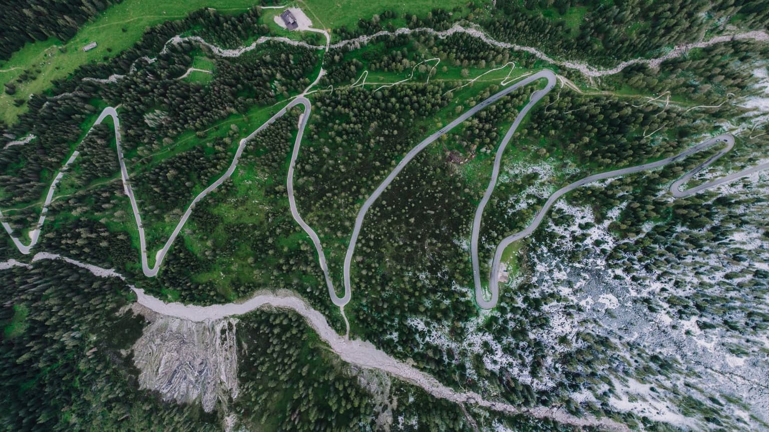
Some pairs are not crossings at all. The fastest line from Ortisei to Braies never crosses a pass: it drops to the A22, the highway (the autostrada) in the main valley, and climbs back up the next one. That is why two famous places that look adjacent in photographs cannot share a day: Lago di Braies needs a morning of its own.
Bolzano to Cortina gets three answers: a local Cortina company publishes about 130 km and about two hours, the mapping service returns a shorter line on a different road, and no official body publishes a valley-to-valley time at all. Add time to whichever you take: drivers here arrive later than the app promised.
If the trip needs more than one corner of this map, it needs a car. The corners you chose then decide where you pick the car up and where you leave it. When the trip ends in a corner it did not start in, price the one-way drop-off against driving back instead - and the drive back is a pass crossing or the loop around the range, so it comes out of the day you leave.
The borders you cannot see
Five passes join the corners of this range, and because each province runs its own roads, a closure is published in three different places instead of one. The passes are the joints in this map. Passo Gardena, at 2,121 m, links Val Gardena to Alta Badia; Passo Sella drops from Val Gardena into Trentino; Passo Pordoi, at 2,239 m, joins Trentino to Belluno; and Campolongo (1,875 m) and Valparola both cross from South Tyrol into Belluno. South Tyrol's tourism board says the same thing on every one of its pass pages: the best way over is not by car.
These passes carry no scheduled winter closure: no seasonal calendar to plan around. Instead, a pass between the provinces can close temporarily and without warning when conditions turn unsafe, and because each province runs its own roads, the status is published in three different places: Veneto Strade for Belluno, Viaggiare in Trentino, and the Province of Bolzano's traffic portal. One crossing can depend on a bulletin you have never heard of.
Bookmark the one your crossing lands in:
Belluno road notices, Veneto Strade (venetostrade.it)
Trentino road status, Viaggiare in Trentino (viaggiareintrentino.it)
South Tyrol traffic report, Province of Bolzano (traffic.province.bz.it)
A pass that shuts on the morning you need it costs the long way around the range, a different day rather than a later one. My rule is simple: any day built on a single pass gets a second version that isn't. A restriction on the western passes is under discussion for coming seasons, nothing settled, so check before traveling.
⚠️ Warning
Read the road-status page of the province you are crossing in on the morning you cross, not the night before. From November 15 to April 15, cars on these pass roads need winter tires or chains on board - check which one your rental has.
On the cross-border shuttle between Toblach/Dobbiaco and Cortina, südtirolmobil Pass tickets are accepted; Mobilcards and the guest pass your lodging hands you are not. That is three provinces running three networks: the travel pass in your pocket stops working on exactly the ride that crosses from one corner of this map to the next, and you buy that seat separately.
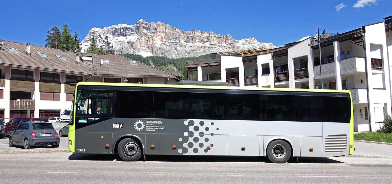
Which ticket to buy, what it covers, how to validate it and which airport to land at is execution, and it lives in the guide that flies you in and moves you around.
Three bulletins and more than one transit app mean the phone is the timetable up here, and a phone without data is a photograph of a bus stop. Set the data plan up at home before the flight, on your own wi-fi, sized for daily map and timetable use rather than the cheapest starter bundle.
Is this the place you think it is?
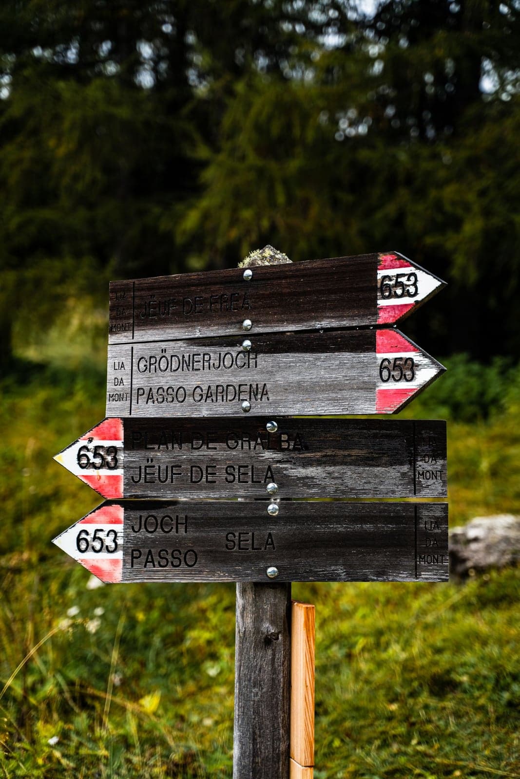
That sign prints the pass twice: Passo Gardena is also Grödnerjoch. Even the boards switch - the company that markets the plateau above Val Gardena is named in Italian, Alpe di Siusi, and publishes under the German one, Seiser Alm. So a name on the map is not always the name you searched for, and two sources that disagree are usually one language apart rather than two places.
The most expensive booking mistake here is a hotel that looks Dolomite and isn't. The check that catches it is free, and I run it on every candidate. South Tyrol's tourism board sorts the province into holiday regions on one page, and seven carry "Dolomites Region" in the name itself: "Dolomites Region Val Gardena," "Dolomites Region Alta Badia," "Dolomites Region 3 Zinnen" (3 Cime in Italian), and four more. Bolzano is not one of them: it is listed separately, as "Bolzano/Bozen and environs." If the board whose job is selling the place won't call it the Dolomites, your itinerary shouldn't either.
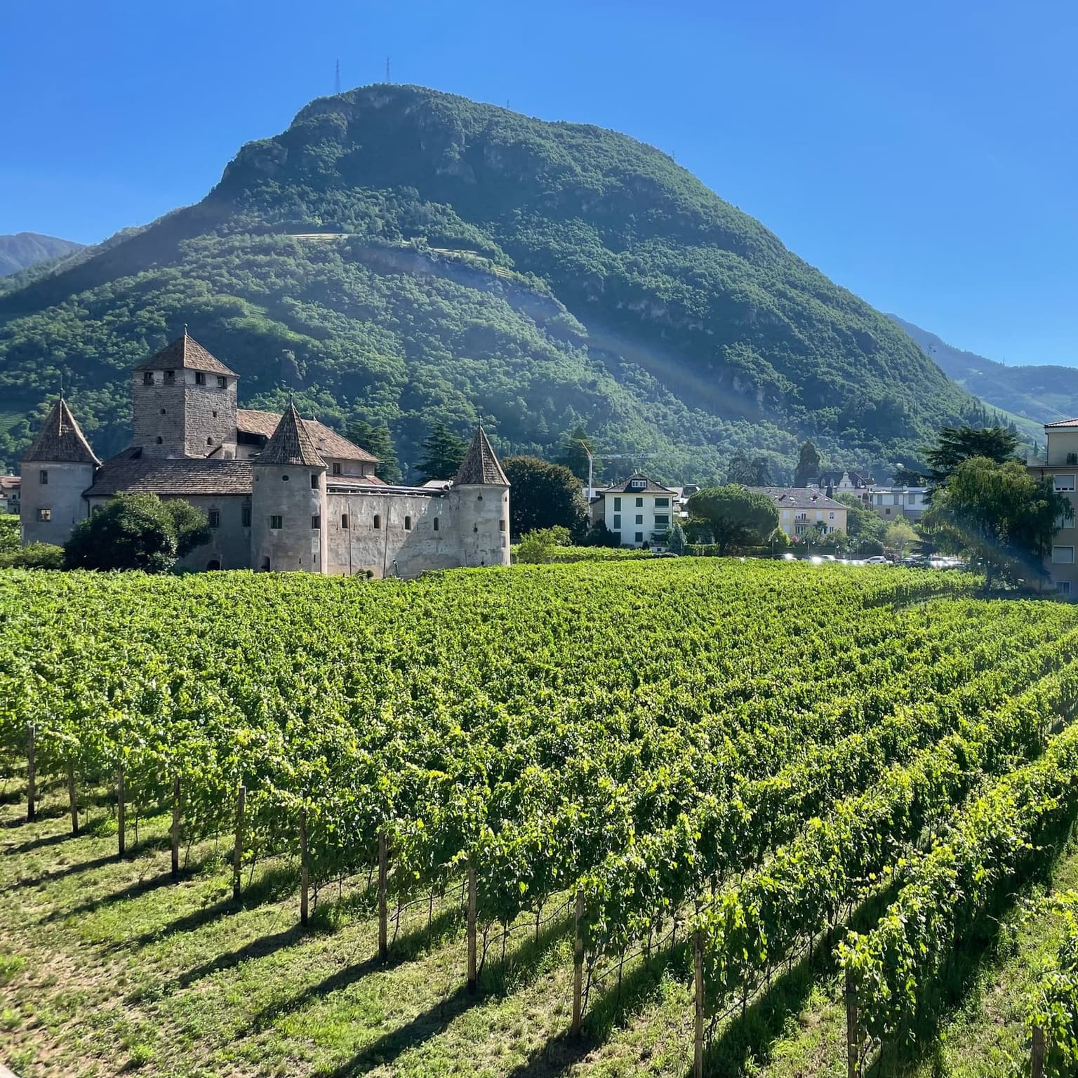
Bolzano fails that check on the board's own page, and it deserves the fair version. The same board calls it South Tyrol's southernmost city and frames the mountains as somewhere you travel out to: the province the range sits in, the obvious rail arrival, the nearest place that behaves like a real city. Gateway, fair. In the Dolomites, no. The range starts up the side valleys above it, and the same test disposes of the wine villages on the valley floor.
A badge is not a promise of a base. Val di Funes holds one and is still a viewpoint with very little around it - a valley you look at rather than one you sleep in, and a day trip out of Val Gardena rather than a week of dinners.
Some names people arrive with are not places at all. The ridge above Ortisei that fills every Dolomites photo feed is reached by lift out of the village and cannot be slept on: the ride up to Seceda is an outing. A sight is a day. A valley is a base.
How much of the map one trip can hold
One move buys two corners of this map and covers most trips honestly; each further corner costs another move, and a move costs a day. That is the number a planner can actually use, and it is not days.
So count the moves before you count anything else. Two works only if you have the nights to absorb them. Three is a road trip with hotel stops. And the corners are not interchangeable: what a single move buys depends on which two it joins. West to east is two passes. West to north is not a crossing at all; that pair goes around the range rather than over it. Two plans that both say one move are not the same trip. The itineraries people send me are almost always one move over.
Which end you start at is a decision too. The western valleys sit closer to the northern and western gateways; the east to the Venice-side ones. The flights booked before anyone looked at a map have already voted on which half of the range is cheap to reach, and on whether the last morning is a short transfer or a pass crossing with a plane to catch. Late in the season the order matters again, because the lifts don't all stop on the same date across the range.
Which side to sleep on, how long the range deserves, huts or one base, and which months open which lifts have their own home: which side to base on, and for how long.
Frequently asked questions
- Is Bolzano in the Dolomites?
- No. South Tyrol's tourism board badges seven holiday regions "Dolomites Region" and lists Bolzano separately, as "Bolzano/Bozen and environs." It is the nearest city and a real gateway; the range starts up the side valleys above it.
- How long does it take to drive across the Dolomites?
- There is no single answer, and no official body publishes valley-to-valley times. As a rule, a pass crossing runs far slower than the kilometers suggest: under 30 km between neighboring valleys costs about 40 minutes. The long pairs go around the range, not over it.
- Why does the same place have two or three names?
- The issuers publish in different languages: the board that markets the plateau above Val Gardena carries the Italian name and publishes under the German one. So a road, a plateau or a village can appear under a name you never searched for, and two sources that disagree are usually one language apart, not two places.
- Do the mountain passes close in winter?
- There is no scheduled seasonal closure on the main Dolomite passes. They can shut without warning for safety, each province publishes its own road status, and cars need winter tires or chains on board from November 15 to April 15.
The Dolomites are nine mountain systems across five provinces, and picking your corner picks the province with it. The range is an archipelago with seams: the province you land in is the one whose road page you read on the morning you cross a pass.