George Mandrovny
Val di Funes in one look - and the view it is not
Val di Funes takes half a day, or a whole one if you walk the loop, and it holds three things: the church view above Santa Maddalena, the small chapel of San Giovanni in Ranui five minutes down the valley road, and the Adolf Munkel Weg, a 9 km loop that runs for three hours under the north faces of the Odle. From mid-May to November you do not drive up to the church: two barriers close that road to everyone except residents and guests staying above them, so day visitors park in the village and walk up, a climb of about 15 minutes. The trap comes in two parts. The postcard is not taken at the church but from a footpath beyond it, and if the picture in your head is that tilted blade of ridge, you are thinking of the far side of this mountain.
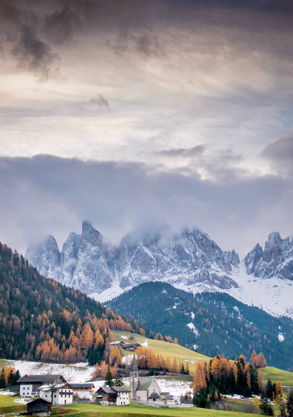
The valley is farmland first and a photograph second. About 2,550 people live here, the meadows are cut for hay, the barns are working barns, and the head of the valley is closed off by the Odle wall - Geisler in German - a line of pale towers standing over the pastures. Two much-photographed churches, one wall, one headline walk: that is the inventory, and it fills a day because of the angle. Everything here looks up. You stand on the valley floor with the rock above you, not on a ridge looking across at it.
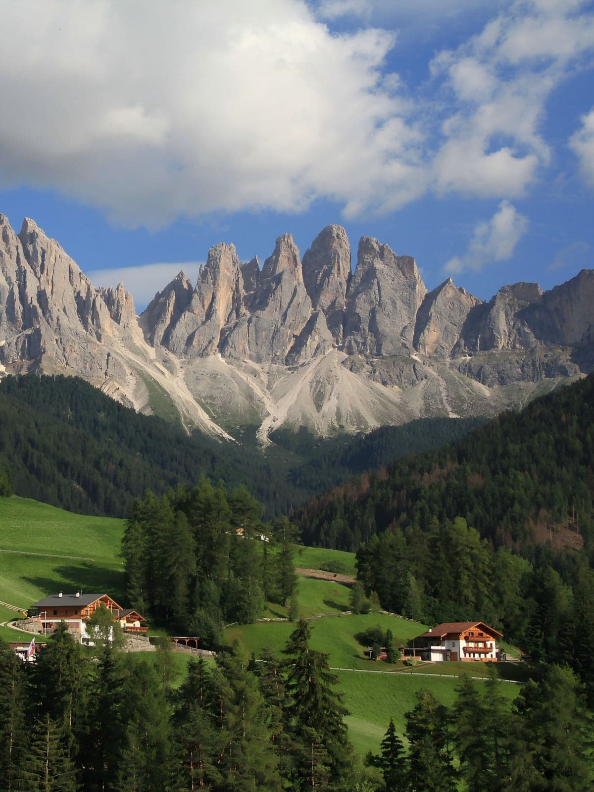
The tilted blade of ridge with the meadow sliding off it - the photograph that sends most people to this part of the Dolomites in the first place - belongs to the summit plateau of Seceda, on the southern, Val Gardena side of the same massif. Both are worth a day. They are simply not the same day, and the Munkel path is how you meet the wall from this side.
Getting in now: a barrier, a traffic light and one hourly bus
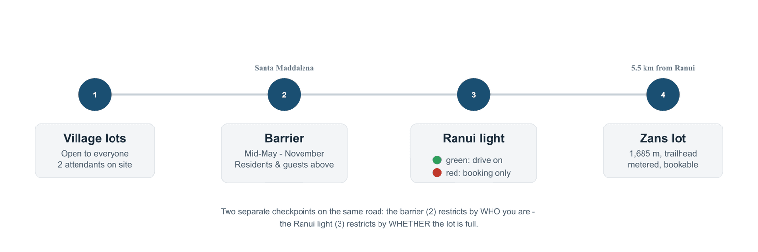
Two barriers do the work from mid-May into November, a change the Italian and German press reported in 2026. Residents pass. Guests of the accommodations above the barriers drive through; a room up there is effectively the permit. Everyone else parks below. Two attendants work the lots, and when the village lot fills, cars are turned back there. Expect to pay for that parking, and expect no dependable number: rates were in flux through 2026, with three incompatible figures circulating for the same lots.
The valley did not do this to be difficult. Mayor Peter Pernthaler puts the load at 500 to 600 visitors a day and hedges the number himself; a resident quoted in the German press counted up to eight tour buses a day in May, June and October, and the new rules cap that at four. He declined to call it overtourism. What he told il Dolomiti in January 2026 was this: "ci vuole ordine, sia per chi vive qui sia per chi vuole arrivare, fare la classica foto e andarsene." Order, he means, for residents and photo-takers alike.
The way around all of it is the 330. It runs from Brixen/Bressanone, signed for Villnöss, the valley's German name, to Zanser Alm, Malga Zannes on the Italian half of the sign, which is the trailhead. It leaves the Brixen train station at :34 past the hour, with the regional train arrivals printed into the operator's own timetable, so the rail connection is designed rather than hoped for. Here I part company with the rental-car reflex: above the barrier a car is a liability, and the bus is the better tool for the trailhead. It goes where you cannot drive and needs no space at the far end.
| Bus 330 (timetable valid December 14, 2025 - December 12, 2026) | What it does |
|---|---|
| Brixen station to St. Magdalena (Filler) | hourly at :34, 07:34 - 19:34; 34 min |
| Brixen station to Zanser Alm (Malga Zannes) | same buses, arriving 08:26 - 18:26; 52 min |
| Zanser Alm back down | hourly 08:35 - 18:35; the 18:35 is the last |
| Last bus out of the valley | 21:42, from the village stops (not the trailhead) |
| Sundays, public holidays | last bus in 18:34, last bus back 19:12 |
⚠️ Warning
The last bus down from Zanser Alm leaves at 18:35, more than three hours before the last bus out of the valley. Plan the walk backwards from 18:35. And check the calendar before you book: no bus runs up to Zannes from March 30 to April 25, or from November 9 to December 13.
Bus 330 Brixen to Villnöss to Zanser Alm, the full timetable, PDF (suedtirolmobil.info)
Drive to the trailhead anyway and you meet the second gate before you see it. The Zans lot, at 1,685 m, is metered by a parking traffic light at Ranui, 5.5 km short of it. Green, drive on. Red, the lot is full, and the only cars that get past are the ones with a reservation already made. Online, a car day is €12; a €40 night rate covers 21:00 to 07:00 at Zans for anything on wheels, and that is the bill that ambushes anyone who pulls in the night before to be there for sunrise. Reservations are binding and non-refundable, the license plate goes in without spaces, and tour buses have to pre-book. One quirk: "no online booking available" does not mean the lot is full; the online quota is capped separately from the physical spaces.
Zans parking lot, online reservation for cars (odlesdolomites.com)
ℹ️ Info
If you are sleeping in the valley, ask at check-in about the Südtirol Guest Pass - Slow Dolomites Card. Nothing gets handed to you: the card is digital, issued free with your stay by participating accommodations, and the tourism office's own advice is to save it to your phone wallet or as a screenshot so it is there when you need it. You cannot buy it at any price. It covers South Tyrol's regional trains and local buses, the 330 among them, takes 50% off parking at Zans and Ranui when you book that parking online, and includes one free entry to the mineral museum at Teis. DolomitiMobil Card, if you meet that name, is the same card under its old one.
A car does earn its place on the wider trip, on the days you move between valleys instead of commuting to one trailhead.
Book the smallest car that clears the valley roads, insurance priced upfront
The other no-car version is to be driven the awkward leg, gateway airport to valley, luggage and all.
Book a transfer from Innsbruck to Bressanone
The shorter, cheaper leg if you're flying into Austria
Book a transfer from Verona to Bressanone
If your trip already routes through Verona instead
The upstream half of the trip - which gateway airport to fly into, and whether you need a car at all - is its own decision, answered in full there.
The Santa Maddalena photograph is not taken at the church
The picture is taken from the Panoramaweg, a signed footpath running along the slope below and north of the church. About 390 meters north and 245 meters west of the building, the geometry lines up: the steeple sits low on its hummock and Sas Rigais stands behind it, church and summit on one line. That alignment is the postcard, and it happens at that one spot; no amount of wandering with a wide lens finds it anywhere else.
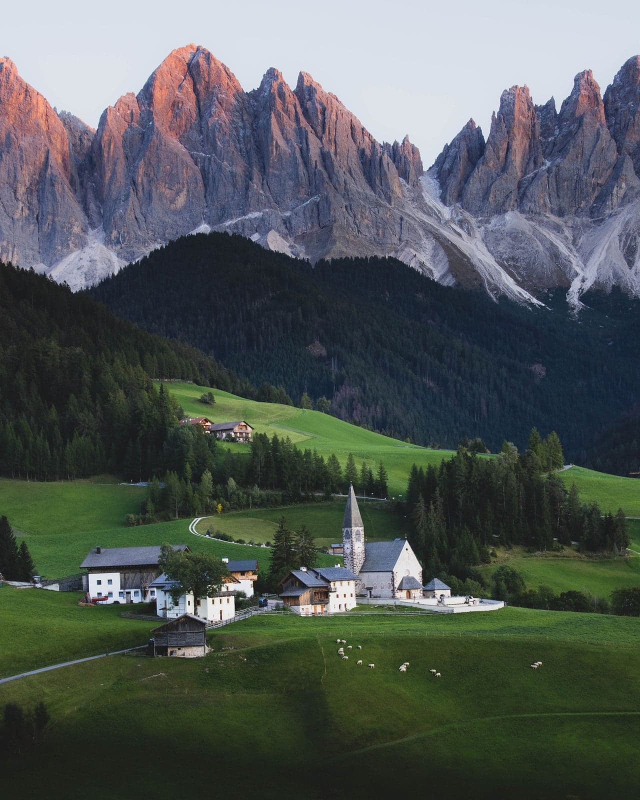
Getting there is a walk, not a drive. From the village square the path climbs as Kirchweg, past Fallerhof and Kaserotthof, to the church. Behind it the way drops north as Magdalenaweg, past the farm called Blauerhof, and meets the Panoramaweg, which is signed by name. No official time is published for that leg: every duration you find online belongs to a longer circuit, one that either never touches the viewpoint at all or loops out to St. Peter and back. So I am not going to invent one, but I can give you my own: call it thirty minutes end to end, square to viewpoint, with a real climb built into the middle of it that never once felt like work - a steady grade the whole way, nothing steep enough to stop and catch your breath over.
Stand at the church itself and the wall is in full view across the valley - what you cannot do is get the building into the frame with it, because you are on the church's own rise, too close and on the wrong bearing.
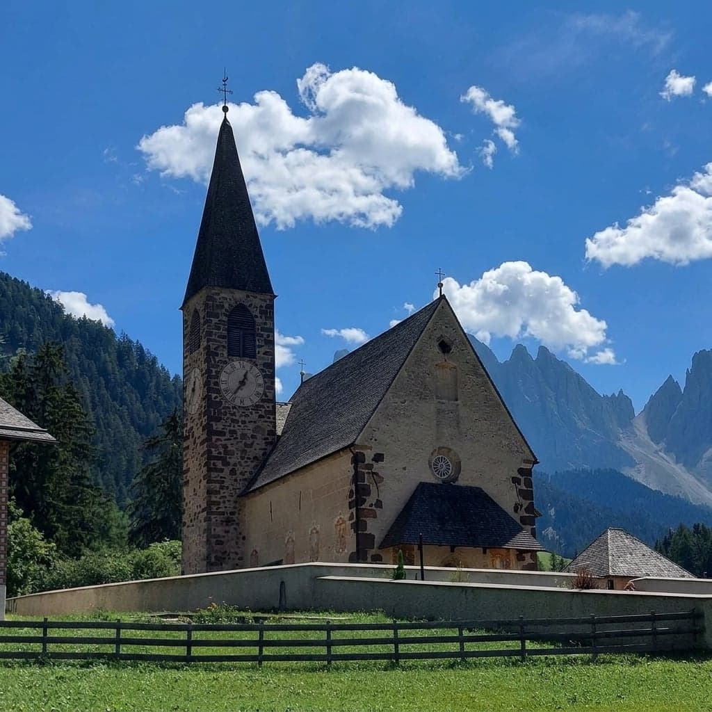
As for light: if the shot matters, arrive at least an hour before the printed sunset - earlier still in high summer, when the valley floor goes flat and shadowed well before the peaks catch up.
In barrier season a day visitor loses less here than it sounds. The climb up from the village lots is the same path that carries on past the church to the Panoramaweg, so what the closed road costs you is the parking space, not the view.
ℹ️ Info
The grass on both sides of the path is a crop, cut for winter feed. Stepping over a fence for a better angle costs a farm part of its harvest, and that is the complaint people who live here actually make. Shoot from the path.
San Giovanni in Ranui: the free view, the €4 view, and the fence
The other church stands by itself in a grazing meadow, a small baroque chapel with the north faces of the Odle going up behind it. This is the composition people arrive with in their heads, and unlike the postcard up at Santa Maddalena, it is roughly the view from the road. The complication is the fence around the meadow, and that fence is the whole story of the visit.
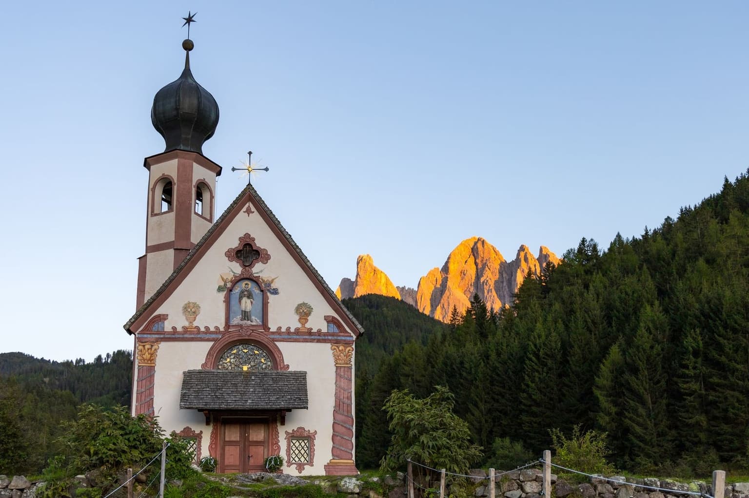
There are two ways to look at it. The free one is a signed roadside viewpoint at the lower edge of the fenced meadow, about 100 m from the parking area; you stand at the fence, and the fence decides your composition. The paid one is a turnstile set into that fence, €4 per person, in place since June 2019, which opens a roped path a short way into the meadow and puts you closer. Still outside.
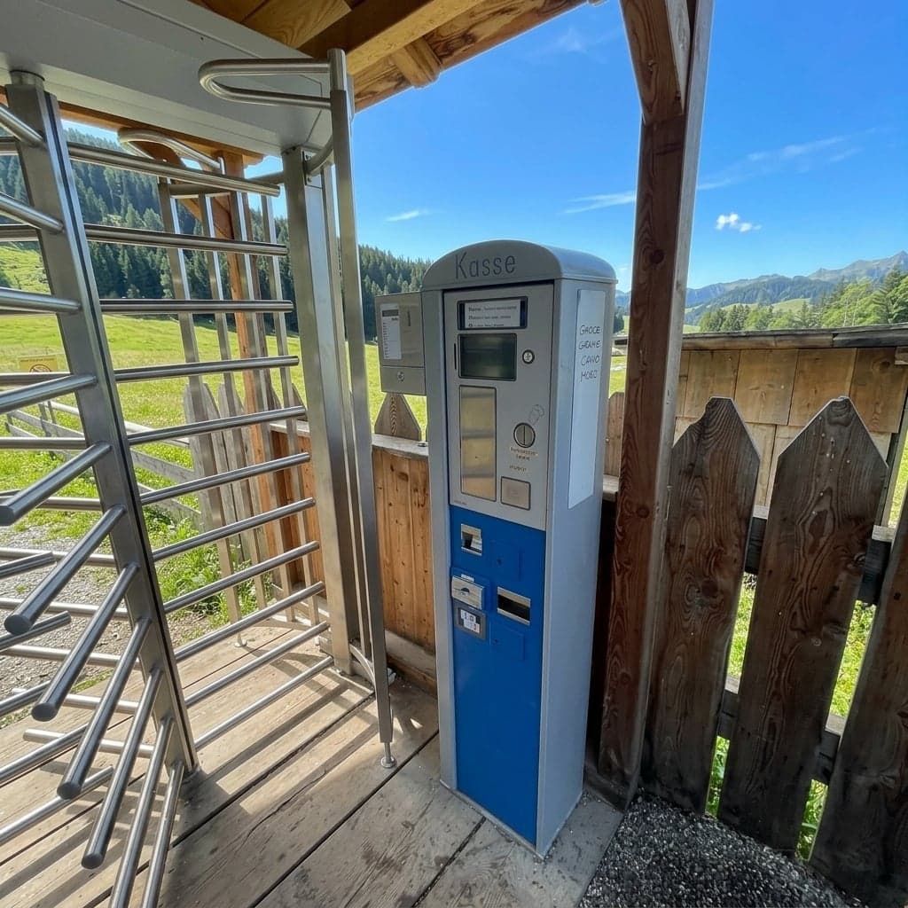
What the €4 does not buy is the door. The chapel is privately owned and stays shut whichever side of the fence you are standing on, which the provincial tourism board says plainly, and people pay at the gate expecting otherwise. Bring coins while you are at it: the machine there is built around cash, and a card is not something to count on.
Whether it is worth €4 gets argued, and the complaints are fair enough to print: it is real money for what amounts to a 50-meter walk into a meadow and an outside view, the fence sits in most of the close frames, and the turnstile lends the whole thing a touristy feel the valley otherwise does not have. My own test is narrow: pay if you want the exterior frame with no fence in it and a few minutes standing close to the building; skip it if the picture you came for is the wide one, small chapel, big meadow, the wall above, because the free viewpoint already gives you that.
Come in the afternoon. The side you photograph faces northwest, so a morning visit puts the sun behind the chapel and you shoot into it; by afternoon the light has come around onto the face you are pointing at.
And yet the first sight of it barely reads as real: the small chapel alone in the grass, dark pine forest banked behind it, the wall jagged against the sky, the whole arrangement almost too perfect. This is the quieter of the valley's two lonely churches - no crowds, the same mountains behind.
The Adolf Munkel Weg: three hours under the north faces
Everything else in this valley looks at the wall from a distance. This is the walk that goes and stands underneath it: the loop leaves the Zans lot, follows the foot of the Odle north faces through forest and open pasture past working summer dairies - the Almen in the hut names up here - and turns for home. Nothing gets climbed, and nothing needs to be.
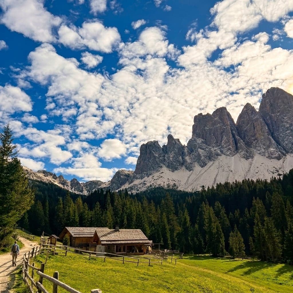
The numbers are modest. Nine kilometers, three hours on the official clock, about 380 meters of climbing. The sequence is worth more than the total: trail 6 out of the parking area, then 35 along the wall past Gschnagenhardt Alm and Geisleralm, then 36 for the return past Dusler Alm.
Which way around, then. The official description runs clockwise, westbound on 35. Past that it is geometry, not opinion: the path traces the north faces, so the wall is beside you the whole way and never in front of you, whichever way you set off. The biggest towers, Furchetta and Sas Rigais, both 3,025 m, stand at the eastern end. Clockwise they slide back behind your left shoulder; counterclockwise they build up ahead of you. Advice that promises better views one way around is selling a distinction the map does not contain.
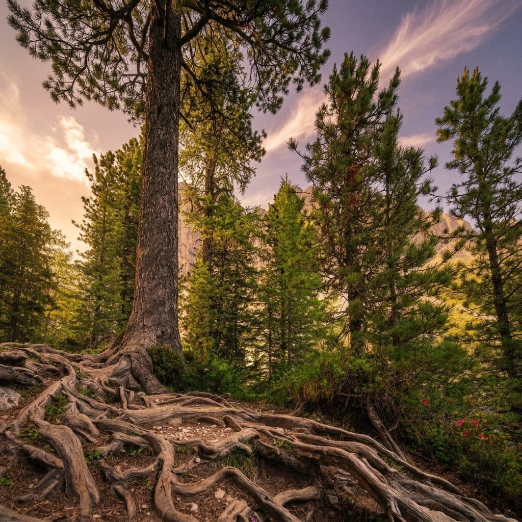
"Easy valley walk" is how the loop gets billed, and the surface disagrees. Tree roots run the length of it, and they are what does the tiring: the footing is genuinely treacherous in stretches, and a full loop can leave every muscle announcing itself the next morning. Three hours is the official figure and I would plan on more.
⚠️ Warning
You cannot walk into this loop over the Panascharte from Val Gardena. That crossing has been closed since August 2020 and was still closed as of July 2026, with Val Gardena's own tourism office confirming the saddle is not accessible. Any route plan that sends you over it is out of date.
The other way people lose an hour is the signage. Junction posts carry numbers and destinations and do not consistently say Adolf Munkel, which is how walkers end up on a shortcut they never chose. Learn the numbers, not the name, and carry the paper map, because the signal comes and goes down here. Tabacco's 1:25,000 sheet 030, Bressanone - Val di Funes, covers the whole loop.
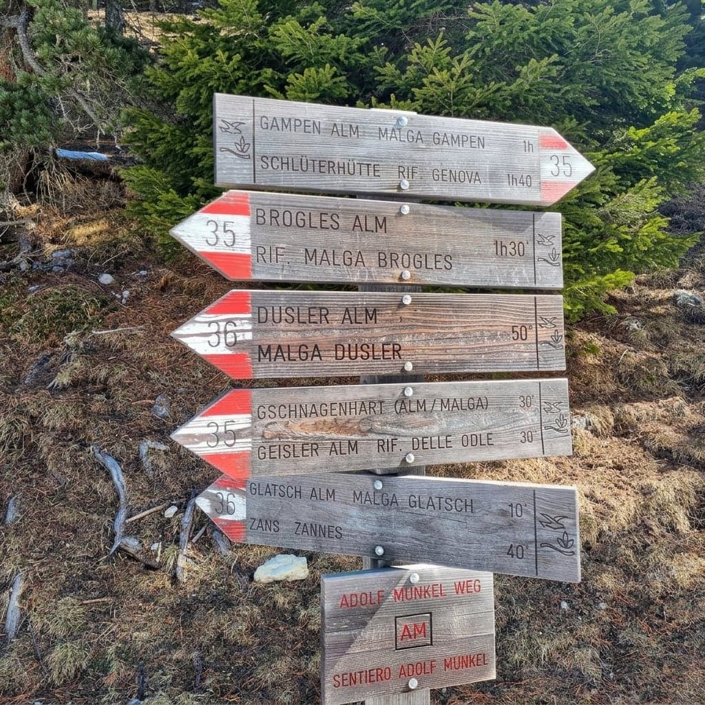
There is a longer version: 6 onto 35 as far as Broglesalm, then 28 down to Ranui. Call it about 12.5 to 13 km and roughly 4 to 4.5 hours, with 593 meters of climbing and 876 of descent, topping out at 2,045 m. The range is not vagueness: the provincial tourism board's own page prints two different figure sets for this variant, so the honest answer is the span they bracket. One dependency before you commit: Brogles is the turnaround, its hours are published nowhere, and walkers keep arriving to find it shut mid-season, which the hut section below gets into. Do not let lunch be load-bearing.
Either version runs on the clock of the 18:35 bus down from Zanser Alm, not the later one out of the valley.
So: three hours on uneven ground, and a lunch you have not staked anything on. It is a walking path, not a via ferrata - no harness, no cables, nothing exposed - which needs saying because the mistake gets made often enough to have been written down.
Guided days on this loop exist, transport to Zannes and the hut timing handled for you - though most walkers manage it fine on their own.
What the loop springs on people is mostly the hour they had not planned for. Haflinger horses graze loose along the trail - in early summer a family of them, foals included, may come running free past you on the way back - and watching them is how an hour quietly disappears. The other surprise is the walk itself: it reads modest on paper, gets nearly skipped, and ends up the day people talk about afterward.
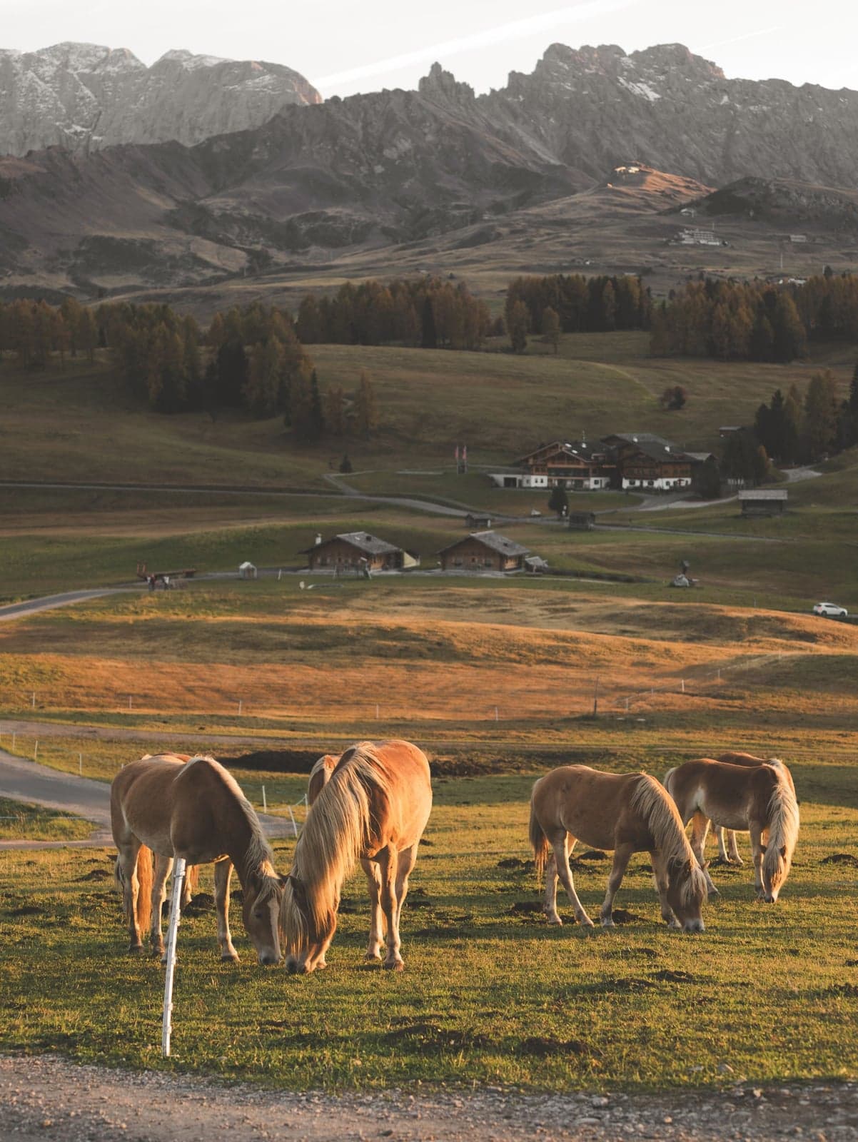
Which hut is closed today
Every hut in this valley takes its own day off, and nobody coordinated the calendar. The weekday you walk decides where you eat, and that arithmetic is cheaper done at breakfast than at a locked door two hours in.
| Hut | Season 2026 | Closes weekly on |
|---|---|---|
| Geisleralm | May 14 - November 8 | Monday |
| Glatsch Alm | May 16 - October 18 | Tuesday |
| Kaserill Alm | May 30 - October 11 | Wednesday |
| Gschnagenhardt Alm | opens June 13, no closing date published (call ahead) | Wednesday |
| Dusler Alm | not published | none published (call ahead) |
| Rifugio Malga Brogles | July to September | none published |
One hut breaks the pattern, which is why it is worth knowing about: Gampen Alm, about an hour and a half on foot above the Zans lot, keeps no weekly closing day and serves from 10:00 to 22:00. On a day when the table has shut the hut you wanted, that is the fallback - but only through September. Gampen runs May 17 to September 30, so it covers none of the October walking the table above still shows open.
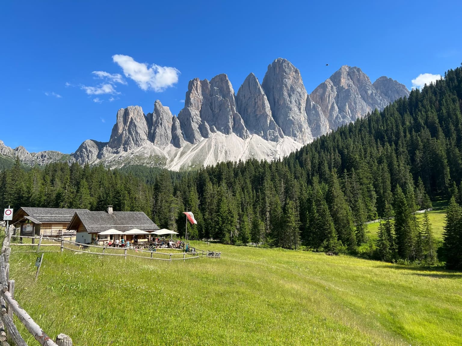
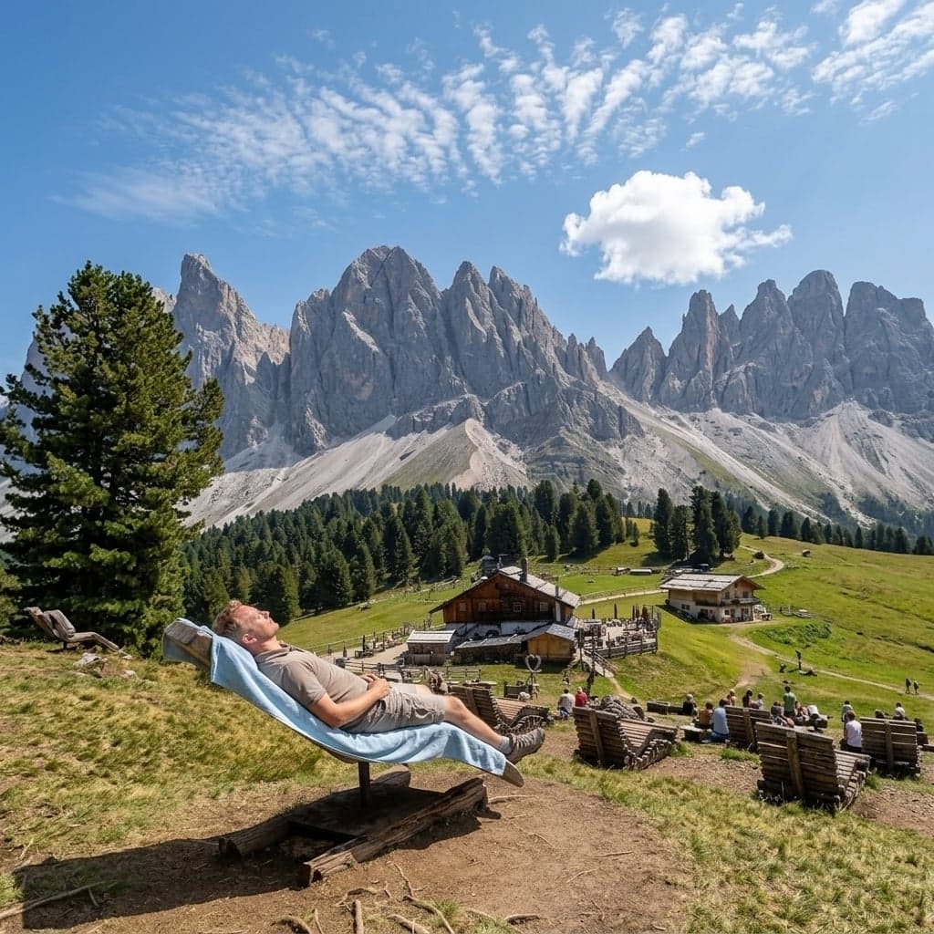
Geisleralm is the one you have already seen in pictures: a rank of loungers facing the wall, which the hut's own site calls its Bergkino, the mountain cinema. That site is also clear about two things people ask at the door: nobody sleeps up there, and tables are held only for parties of 15 or more, so on an August midday you wait like everybody else. Service runs at the table only - there is no counter to grab a drink from - and at peak the kitchen is in no hurry: figure ten minutes for a cappuccino, more for the cake, at full mountain prices.
On a busy midday do not count on a lounger; the grass right beside them works just as well - lie down there and the wall looks exactly the same from flat on your back. The neighboring huts along the same stretch keep their own rows of chairs, generally with fewer people fighting over them.
If lunch has to be a plan rather than a hope, Kaserill Alm is the one hut on the loop that puts its kitchen in writing: hot food from 10:00 to 16:00, cold plates and cake until 17:00. That is the latest real meal published anywhere on the loop, and it is what I would time the back half of a long walk against.
Two of them tell you nothing. Dusler Alm publishes no rest day at all - the official listing's opening-hours field is blank, and the directories that do show a week show all seven days - so treat it as a phone call rather than a fixture. Brogles is the costly one: it is the turnaround on the long version of the walk, its season is given only as July to September with no dates inside it, and no hours have ever been posted. Call before you go - by mid-September the staff can already be closing up shortly after 15:00.
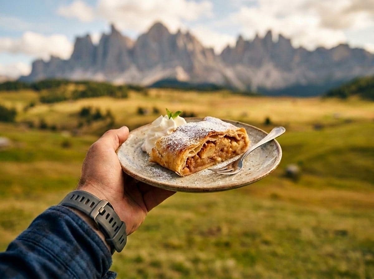
No hut up here publishes what it takes at the till, so carry cash the way you would anywhere in the mountains. And arrive hungry: up here the coffee can come with cream from the hut's own cows, the strudel arrives as a slab, not a slice, and Buchteln, sweet yeast rolls, are worth a planned stop all by themselves.
The flat day: the Zannes nature trail, and who it actually works for
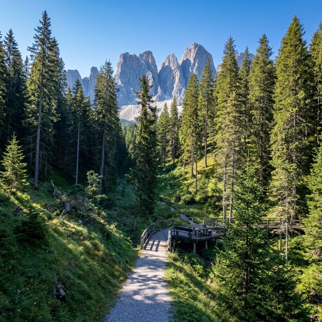
Not everybody in the party wants three hours of tree roots. The same lot that starts the Munkel loop starts something much smaller: the Naturerlebnisweg Zans in German, Sentiero natura Zannes in Italian, a 3 km interpretive circuit with 17 stations, some of them in Braille. Ninety meters of climbing and the same back down, and the provincial board clocks the loop at 51 minutes, which becomes an hour the moment somebody actually reads the boards.
The accessibility question has two answers, both accurate. The park authority calls this South Tyrol's first wheelchair-accessible interpretive nature trail, and puts the maximum designed slope at 8%. Südtirol für alle, the survey project that came with a measuring wheel, rates it restricted: 12 to 14% on the opening ramp, then a constant 10% over gravel. I would plan around the measured figures: the path is genuinely built for a chair, but a solo manual user should not meet that opening ramp cold - count on a pusher.
One catch lands hardest on precisely the people this trail is built for: it starts at the Zans lot, which sits behind the Ranui traffic light. On a red day, no reservation means no drive up. The 330 still runs to Zanser Alm.
The other thing that happens up here in summer is Dolomiti Ranger, a guided park morning for children 7 to 12 with an adult along, meeting at the UNESCO Info Point at Zans - figure €25 per adult and €10 per child, half that with the guest card. Book by the day before; it is not a walk-up.
Dolomiti Ranger, the 2026 dates, prices and the booking itself (kultur.bz.it)
When to come: fall, and the two windows when the valley shuts
Fall is the window I would book - the light is the year's best then, and walking the fields costs nothing in effort. The larches turn, the meadows go gold under a bright sky, and the wall behind stays the same pale gray it is in July. That contrast is the argument for coming late.
The rest of the year runs on three calendars that do not line up: the barrier, the bus up to Zannes, and six kitchens.
| Window | The barrier | Bus to Zannes | Huts on the loop |
|---|---|---|---|
| Spring, to mid-May | not in force yet | hourly apart from the spring gap | no hut with a published season is open yet |
| Mid-May to late June | in force | hourly | opening one by one |
| July and August | in force | hourly | every hut with a published season is open |
| September into November | in force | hourly | closing one by one |
| November 9 to December 25 | ends in November | back on from mid-December | every one shut |
| From December 26 | not in force | hourly | winter seasons open |
Nothing gates the trail itself. What the calendar decides is whether anything on it is open, and whether you can get to the trailhead without a car. Two windows fail on both counts. The first is the spring gap, when the huts have not opened and the bus stops short of Zannes. The second is longer and catches more people: November 9, where the hut closings and the bus's winter gap meet, and from there until Christmas there is nothing open on the mountain at all. The kitchens come back the day after Christmas rather than in mid-December. Geisleralm's own winter season opens December 26, and so does Gampen's.
⚠️ Warning
Summer afternoons in these mountains build thunderstorms, and the open pasture on the loop is the worst place to be standing in one. Start early enough to be off open ground by mid-afternoon. The version of this that got written down was 15:00 in mid-August, on an open plateau with no shelter.
The other end of the season squeezes too, and earlier than the table looks. By the second half of September the valley floor can already be down to hardly any open restaurants, with the ones still serving fully booked.
Everything the access section laid out tilts one way if you sleep up here. The room above the barriers is the permit, the guest card comes with it, and the first and last hours of the day belong to whoever is already in the valley rather than to the cars still coming up from Brixen.
One day covers Funes. The rest of a Dolomites week has gates of its own, and the two obvious neighbors meter their access much the way this valley does. Tre Cime's toll road has to be booked before you drive up to it. Braies closes its valley road for the summer, which makes the lake a reservation rather than a decision you make that morning.
The rules that carry a fine: drones and campervans
Two rules catch people who thought they were just parking, or just flying. The whole valley lies inside the Puez-Geisler nature park, and the park is a no-drone zone, full stop, with fines that run up to €6,000. Plan on not flying here.
Campervans get fined for something drivers never see coming. Sleeping in a legally parked, road-legal van is not camping; the gear is what crosses the line, and where municipalities have adopted South Tyrol's model ordinance the fine runs €300 - €1,800, plus clearing it all away on the spot at your own cost. The valley's only official camper area is a converted ice rink, paid and basic; the free village lots keep proving they are not it - within the last year overnighters there have been woken and fined.
⚠️ Warning
Any one of these turns a parked vehicle into camping: resting it on more than its wheels (support legs, platforms, chocks), taking up ground beyond its own footprint (an awning, a table, chairs, containers, gas bottles), emptying liquids or organic waste, or putting up a tent, gazebo, or tarp. The legs and the chairs are what catch people: they come out before anyone decides anything.
Val di Funes FAQ
- Where exactly is the Santa Maddalena viewpoint, and why isn't the photo taken at the church?
- On the signed Panoramaweg, a short walk downhill past Blauerhof, about 390 meters north of the church - the one spot where the steeple lines up with Sas Rigais. From the church the wall is in full view; you just cannot get the church into the frame with it.
- Can you still drive up to Santa Maddalena in 2026?
- Only as a resident or a guest of an accommodation above the barriers. From mid-May to November everyone else parks below and walks up - figure about 15 minutes on foot.
- Can you go inside San Giovanni in Ranui, and is the €4 worth it?
- No - the chapel stays locked whichever side of the fence you stand on. The €4 turnstile buys a roped path across the meadow and a closer exterior view: worth it for the unobstructed frame, skippable if you came for the wide composition the free viewpoint gives you.
- How long is the Adolf Munkel Weg, and how hard is it really?
- The standard loop from Zannes is 9 km, three hours, about 380 meters of climbing; over Brogles it becomes about 12.5 to 13 km and 4 to 4.5 hours. Not a via ferrata, no harness - but tree roots run the length of it and do the tiring.
- When is the best time to visit Val di Funes?
- Fall, for the larch color under the wall and the best light of the year; the huts close one by one through October, with Geisleralm's published season running to November 8. Avoid November 9 to December 25: nothing on the mountain is open and the bus to Zannes stops until mid-December.
A farming valley decided to meter its own fame: barriers from mid-May, a light at Ranui, a turnstile in a fence. Come on its terms and the wall is overhead for three hours.